

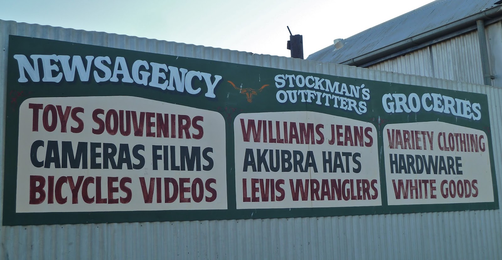
In Queensland tourist guides from a decade ago you'll find recommendations to visit Freckleton's General Store in Camooweal. From this shop it was possible, at one time or another in its long history since the early 1900s, to buy airline tickets, blankets, cow licks, drapery, equipment (all sorts), feedstuffs, groceries, hats, ices, jeans, kerosene lights, liquor, mosquito nets, needles, oil, pharmaceuticals, Queensland souvenirs, reading materials, saddles, tobacco, vehicle parts, washing machines, xylophones, yams and zips. OK, I made the last three up, but they may well have been sold. In the days before The Isa existed, this store was where everybody in northwest Queensland came to do their shopping, every-day or special-occasion.
I've been to this kind of store before in the Outback, and it's an education, not to mention the photo ops. I was therefore keen to visit Freckleton's before we left Camooweal next morning. But it was boarded up, as was the museum next door, where I had hoped to search for evidence that my explorer hero, Ludwig Leichhardt, had travelled through the Barkly Tableland on his ill-fated last expedition to the Swan River. The store closed in 2009, its elderly owner, Ada Miller (née Freckleton), unable to resist the inevitable in a world of specialisation, high transportation costs, and cut-price multi-pack supermarket deals. I wonder if Blueprint for the Bush* initiatives might also include support for the continued existence of a store that supplied everything for the community and well beyond, not to mention the tourist draw. Who would want to go into The Isa by choice, I ask you?


Today Camooweal Post Office (above) is the general store. Now we all know Australian post offices don't open until 9 am. How much use is that on a summer morning when you've been up since 5 and you need milk for breakfast… and you're not a dairy farmer?
Camooweal calls itself the 'Gateway to the Northern Territory', the border with which is 13 kilometres west of the town. We toyed with the idea of going there, but not for long: state borders have long been a source of disappointment. William Landsborough first came through this area when he was looking for Burke and Wills in 1862. The town was founded in the 1880s, and its position as a border town made it a customs collection point as well as the frontline in the battle to prevent the spread of cattle ticks across northern Australia. It was an important dipping point for large numbers of cattle being moved interstate.
Although Mt Isa wasn't founded until the 1930s, it soon outgrew Camooweal. Such is the reach of the city council's administrative jurisdiction today – roughly the size of Switzerland, they say – Camooweal is considered to be a suburb, despite being nearly 200 km away. People jokingly describe the Barkly Highway as the longest main street in the world, which seems a strange concept to me.
I liked Camooweal; I liked the idea of Camooweal. It had that prerequisite for a memorable Outback town – silently circling Black Kites. I liked its droving history. You can visit The Drover's Camp, a shed full of memorabilia on the eastern edge of town, and there's The Drover's Camp Festival every August, which we missed by about a week.
Bundaberg artist Craig Nelson created this bronze statue based on drover Sid Biondi and his horse, and donated it to the people of Camooweal in 2014. Sid was a contract drover who moved huge numbers of cattle across the Northern Territory stock routes from the 1940s to the 1960s. His father had been a pack-horse mailman in the town in the late 1800s.

And so, off to Mt Isa, 'Australia's Rodeo Capital & Premier Mining City', one sign claims. If you remember, we nearly went on last year's Outback trip, but I thought better of it. This time it had to be ticked off: the mining capital of Queensland often finds itself on lists of iconic Outback towns. There were only two things of note during the 189 kilometres: bizarre anthill adornment, and a fire at our halfway breakfast stop.


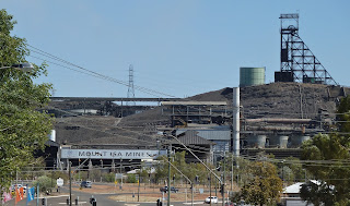

 From there we walked around the town centre, which was hot and characterless, and every time you turned a corner you could see the red-and-white-striped stack of the copper smelter, and the taller chimney of the lead smelter. The former puthered continuously. (Puther is one of many words invented by my Aunt Edith: it means the emission of smoke or fumes continuously or in regular puffs; from a car exhaust, fireplace or stack, for example.) It took ages and much asking to find a coffee shop in Mt Isa, but we did strike ore in an unlikely souvenir shop (shhh, don't tell the geologists). I badly wanted to leave town.


You can still see the town's layout, but the houses have long since been dispersed. (Literally moving house is quite common in Australia.) Much more exciting, however, is the water-filled pit at the mine site. It is not easy to get to and totally out of the question without a 4WD, and even then only if you're happy negotiating steep, rock-strewn slopes. This is the creek crossing right at the beginning of the track.
 Tourists are not encouraged to visit Mary Kathleen. We had to ask how to find it at Mt Isa visitor centre, and we were given this, which reminded me of a map of how to find buried treasure. You'll notice that it doesn't actually show the way to the mine site.


Someone – and I suspected those leaving the rest area in a Kombi Van as we pulled in – had made a fire between the two arms of a substantial forked log on the ground. There were flames when we arrived, but they had died down before we doused the smoking wood with water. There was less smoke by the time we left, but we decided to report it to Mt Isa fire services, just in case it flared up again.
Whatever way you look at it, there is no escaping The Isa's industry. What must this look like in the rain? The sign on the way in from the west – 'Birth Place of Champions' – refers to celebrities such as Pat Rafter and Greg Norman (and a whole host of other people I've never heard of) who were born here.


The Visitor Centre in the main drag, Marian Street, was disappointing. My friend wanted samples of the ores that are the basis of the town's wealth, but they looked at him as if he was weird when he asked. The Hard Times Mine tour takes two and a half hours in 1.2 kilometres of purpose-built tunnels complete with machinery and noise (at a cost of $5 million), and you have to dress appropriately in mining safety gear and boots, as if it were real and not an experience. The shop sells hi-vis jackets for little wannabe miners.


But before the getaway we had to drive up to the City Lookout to view the industrial landscape from a different vantage point.

 |
| Hills of spoil |

 |
| Look the other way, see no chimneys |


In Welcome to the Outback, Sue Williams describes a T-shirt I should have bought myself: 'Happiness is Mt Isa in the rear-view mirror'.
A prospector named John Campbell Miles was just passing through this area in 1923 when he came across an outcrop of silver-lead ore (there is also zinc and copper). Soon, hundreds of men came to stake a claim at $1 an acre. Heat, isolation, living rough and back-breaking work made for a grim existence. Mount Isa Mines was one of three companies established the following year, but MIM quickly absorbed the other two. A town grew up within a couple of years and the railway arrived in 1929. The history of mining in Mt Isa was one of many lean years before prosperity and growth. Xstrata bought Mount Isa Mines in 2003 before merging with Glencore in 2013. Glencore Xstrata became Glencore the following year.
A prospector named John Campbell Miles was just passing through this area in 1923 when he came across an outcrop of silver-lead ore (there is also zinc and copper). Soon, hundreds of men came to stake a claim at $1 an acre. Heat, isolation, living rough and back-breaking work made for a grim existence. Mount Isa Mines was one of three companies established the following year, but MIM quickly absorbed the other two. A town grew up within a couple of years and the railway arrived in 1929. The history of mining in Mt Isa was one of many lean years before prosperity and growth. Xstrata bought Mount Isa Mines in 2003 before merging with Glencore in 2013. Glencore Xstrata became Glencore the following year.
There is obviously masses more to the history of Mt Isa and mining, but I am rapidly losing the will to research, just as I quickly lost interest in staying for any longer than a brief visit. Iconic Outback town some may claim it to be, but it's far from my idea of such a thing. It did, however, have circling Black Kites to commend it.
Back on the Barkly Highway, we had a new mission, to spot a Hill Kurrajong, a rare deciduous tree that is only found in shallow soil on rocky hillsides around Mt Isa and Dajarra in northwest Queensland. It is slightly bottle-tree-shaped and has bright green leaves at the end of the dry season, unlike many other trees, making it easier to identify. It didn't take long to spot a couple, from the road.

Mt Isa depressed my enthusiasm to such an extent that I didn't find the Leichhardt River on which the city sits. So I was pleased to come across an eastern branch half way to Mary Kathleen, our next port of call. There was no water in it, natch.


Then I had a bit more practice with these, including a 4-er.

 In 1954, two prospectors broke down in a dry river bed. One of them swept the area with a Geiger counter, as you do. He found uranium oxide; a subsidiary of Rio Tinto mined the mineral; and a new town was built for 350 people and named after the prospector's late wife, Mary Kathleen McConachy. The UK Atomic Energy Commission provided some of the money to get the project off the ground. The mine was closed by 1984, however, as a result of the oversupply of uranium on the world market.


The town's people were not happy about having to move away when the plant and the town was sold: they'd loved living in a town equipped with many amenities that had been built to attract them in the first place.
You can still see the town's layout, but the houses have long since been dispersed. (Literally moving house is quite common in Australia.) Much more exciting, however, is the water-filled pit at the mine site. It is not easy to get to and totally out of the question without a 4WD, and even then only if you're happy negotiating steep, rock-strewn slopes. This is the creek crossing right at the beginning of the track.


We missed a fairly important 'Mine' sign, a homemade job someone had stuck to a tree to be helpful, and then took another wrong turn. GPS wasn't any use because we were off track, but we measured 6.1 km from the turn-off to Mary K township, per the instructions. We met the only other visitor on the way up. I didn't think he should be there, so close to what must be contaminated water. All the trees in the water were dead, not surprisingly, but it took a while to realise, while we were walking round the pit, that there were no birds, or lizards, or insects. I think there were flies… it was hot.


The stepped rock faces of the pit were streaked with red, white, ochre and blue-green, where minerals have been oxidised. The water was turquoise and quite inviting in the heat. I can imagine some crazy Aussies would go for a dip. There was no sign of the camel on the way down.


This is the beautiful country we were in. On the way back to the Barkly, we spotted another wonderful example of the Hill Kurrajong, requiring just a little walk to reach it.


This part of northwest Queensland is, or was, big mining country. South of the Barkly Highway midway between Mt Isa and Cloncurry are the copper-rich Argylla Ranges where three towns – Bulonga, Ballara and Hightville – sprang up in the early 1900s, then died a death just as quickly after the First World War. The Ballara Heritage Trail is a 4WD track through the Ranges and the towns, and includes a rock hole and waterfall known as Fountain Springs. We had already made choices that didn't include this detour, unfortunately.
Forty-three kilometres west of Cloncurry, by the Corella River, is a memorial to Burke and Wills who passed this spot on route to the Gulf.


Our destination for the night was Cloncurry, not Katherine**. When I booked the Gidgee Inn Motel, I'd opted to pay a bit more for what was then going to be the night after camping-and-possibly-not-showering. Plans subsequently changed, and we added Camooweal to the itinerary. So we had a pleasant room (and bathroom) with a big bed, and there was good though pricey food in the restaurant. We quickly unloaded from the car, looking forward to a beer in the bar.
The Motel was full of mine workers in shiny new utes that exhibited irritating reverse-warning noises and locking-door beeps. In the restaurant, there were uncouth, pissed poor dressers – men with tattooed legs in short swim shorts and flip-flops – who were loud laughers and didn't care. Call me a whinger, but I am simply intolerant of crass thoughtless people. These weren't the first on this trip. At the biggest Ghost Gum near Trephina Gorge in the East MacDonnell Ranges, we had just got out of the car to marvel at this remarkable tree, when a large more-truck-than-camper pulled into the car park. It created clouds of dust as it pulled up just beyond where we were standing. A large ugly brute of a man got out and started up some kind of self-inflating device on his tyres. Cue even more dust, and hideous noise in a wonderfully peaceful place.
On that occasion we got back in the car and left: this time, we distracted ourselves trying to choose from several options for the next two days. I think it was at this juncture I first mooted the idea of extending our trip by a day.
** see Outback 3 Route revisions, June 2015


No comments:
Post a Comment