April 30, 2012

Anzac Day (Australia Day 2)

I've been in Australia for three Anzac Days, but I'm only just beginning to get to grips with what it's really about. 

It's a much bigger deal than Remembrance Day in the UK. For a start, many people get up at four o'clock in the morning to be in position at their community war memorials for the Dawn Service at 5am; to stand in quiet contemplation of all those who have given their lives in the wars in which Australia has participated, starting with the First World War. Whole families attend, including the very young and the very old.

Later in the morning there are slightly more celebratory gatherings including marches-past by veterans, currently serving members of the Defence Force, scouts and guides and others in uniform, and then social get-togethers, often at RSL* clubs. Anzac Day is a national holiday and trading hours are restricted. Last year, when 25 April coincided with Easter Monday, the latter was moved to Tuesday, such is the level of reverence for the day Australian and New Zealand troops landed on the Gallipoli peninsula in Turkey, where they met fierce opposition from Ottoman Turks defending their strategic position.

The idea was to open up the vitally important Dardanelles straits to the Allied navies: the Ottoman Empire was allied to Germany. But things did not go according to plan; the fighting lasted eight months before Allied soldiers were evacuated. Eight thousand Australians had lost their lives and many more had been seriously injured.

The Commonwealth of Australia was only a few years old at the time: the federal government was keen to establish Australia among the nations of the world. But the soldiers' efforts and bravery was of even greater import to Australian citizens back home, and it is just as significant today. I can't put it better than the Federal Member for Brisbane, Teresa Gambaro, who sent us all a leaflet with details of Anzac Day happenings.
The Anzac spirit of courage under fire, selflessness and unswerving loyalty, tenacity and mateship was forged in the battles at Gallipoli. The legend of our Anzacs has transcended time to become a symbol of what we value as Australians.
As Australians bake their Anzac biscuits, turn out in their hundreds of thousands and cheer on Collingwood or Essendon at the MCG in the traditional Anzac Day Aussie Rules contest (which sometimes draws a bigger crowd than the AFL season finals), there are underlying issues to think about, too.

Anzac fever twas not ever thus. Jeff Sparrowª in the Overland literary journal reminds us that Anzac Day in the 1980s was a lot less of a 'turbocharged festival' than it is now; and, nearly 100 years ago, bravery of a different kind was shown by the many Australian non-combatants who opposed the slaughter of soldiers in Europe, some of whom protested in one of the first-ever anti-war demonstrations. Peace activism has never, however, precluded sympathy and respect for soldiers themselves.

In understanding the significance of Anzac Day to Australians, other social commentators mention the desire for a physical ritualistic connection in an atomised world in which we sit alone at computer screens for rather longer than we spend bonding within our local communities. Many people, as well as craving a universal meaning to their lives, need what Scott Stephens of ABC's Ethics department calls 'social glue' in order to connect in an increasingly secular, less civil society.

I defy anyone not to be moved when they hear The Last Post or The Ode from the elegy For the Fallen. Both are just as relevant to the memory of the millions who perished in the First World War as they are to the men and women killed in action in Afghanistan. As Australians recover the Anzac spirit and stand back in wonderment of the heroics of war, they may find the historical details a little less palatable; in particular major political misjudgements. At what point does disinterest in telling the complete truth become dishonesty. Truth is important for national wellbeing, otherwise 'social glue' becomes even less sticky.

In this case, Jeff Sparrow concludes, 'the only decent commemoration entails ensuring that nothing comparable ever happens again.'

* the Returned and Services League of Australia, a support organisation for those who have served or who are currently serving in the armed forces. RSL clubs perform as great a role in many communities, however, as social hubs
ª http://overland.org.au/blogs/new-words/2012/04/anzac-day-celebrates-forgetting/


This post was last updated on 1 May 2012


April 27, 2012

It fracking affects us all

In the UK last week, the findings of an investigation into earth tremors that followed exploratory shale gas* operations near Blackpool in the Northwest of England last year were made known. There had been doubts about the safety of the gas extraction method hydraulic fracturing** (also known as 'hydrofracking' or 'fracking') in areas of known seismic activity. Now, a report compiled by an academic from the Applied and Environmental Geophysics Research Group at Keele University (Staffordshire, UK), an independent fracking expert and the head of seismology at the British Geological Survey has concluded that it's safe to resume shale gas exploration, not just in Lancashire but across Britain, with one or two amendments to procedure.


One of the suggestions in the report concerns 'well integrity'. The second of the Blackpool tremors caused 'deformation' of the well's structure, which obviously raises issues of leakage and contamination. Cuadrilla Resources, the drilling company, have been asked to test whether the well's casings are intact. Seismic and well-structure monitoring surely need to be a permanent and integral part of gas mining procedure.


This report deals with only one of many controversial aspects of fracking, and has been criticised for such. When the findings were published in The Guardian in the UK last Tuesday one of many reader comments described the writer's experience of living in the middle of the shale boom in Pennsylvania. He mentioned the huge water consumption of each well; the large tanker fleets involved in bringing in water supplies and disposing of waste water and its contaminants ('fracking backwash') which include large amounts of salt; the associated escape ('fugitive emission') of some methane (one of the worst greenhouse gases for carbon emissions); the sheer number of wells and pipeline network required to mine a deposit; and the noise and pollution surrounding those wells. Other, wider issues of mining gas include the pollution or depletion of aquifers and groundwater; air pollution by petroleum hydrocarbons produced at fracking sites; and the despoiling of fertile agricultural land and beautiful landscapes (thus affecting tourism).


Much of the debate about this second dash for gasª misses a far more fundamental point, however. Extracting and burning natural gas will produce more greenhouse gases and therefore exacerbate the world's current difficulty in arresting anthropogenic climate change. Shale gas and coal-seam gas* may produce half the carbon dioxide that coal does, but they are by no means 'clean'. A by-product of mining shale gas can be the radioactive gas radon, a consequence not yet fully investigated. Gas is often touted as an interim measure, a halfway house between dirty coal and clean renewable forms of energy, but it is at best a short-term stop-gap rather than the answer to future energy demands in a carbon-challenged world, and will delay the day that renewables come into their own.


The bottom line is that most governments – regional, state or national – cannot resist the enormous profits to be made from the exploitation (including export) of vast reserves of relatively cheap fossil fuels. And with the promise of wealth comes the carrot of employment. I have never heard the threat to jobs being used as deftly as it is in Australia, whenever legitimate concern is expressed about the impact of the mining boom on human health, forests, unique ecosystems, habitats, water systems and even the Great Barrier Reef. Place people in sufficient fear for their livelihood and they will condone their politicians' ostrich-like attitude to a far greater impending disaster.


There are shale and coal-seam gas deposits in every continent on earth, being surveyed, subject to planning consents or environmental impact statements, or already in commercial production. Across the globe there are activists – be they farmers or parents or environmentalists – asking important questions about the loss of strategic cropping land, the noise and dust in their backyards where their children play, or chemical pollution from fracking. Sooner or later, down a lane near you, a rig will trundle into position and there will probably be very little you can do to stop it. Among all the other issues you may raise, one you must ask is what price a clean-energy future?


* natural gas is a naturally occurring hydrocarbon gas composed mainly of methane and associated with oil fields and coal beds. Shale gas and coal-seam gas (aka coal-bed methane) are examples of where the methane has been absorbed into the deposit: they are very similar chemically and produce the same amount of heat and carbon dioxide (roughly half that of brown coal). Shale gas extraction always requires fracking, whereas about half coal-seam gas reservoirs necessitate fracking. Shale gas is exploited extensively in the United States: Australia has huge deposits of shale gas as yet largely unexplored. Both countries have large coal-seam gas deposits, but Australia is closer to commercial production (mostly for export)
** see also Bimblebox, March 2012
 http://www.guardian.co.uk/environment/2012/apr/17/gas-fracking-gets-green-light
ª the first was the move by newly privatised electricity companies in the UK in the 1990s to generate electricity using natural gas


This post was last updated on 28 April 2012


TY7EXGMBU98J

April 21, 2012

Why it's magic

I went to Byron again.


I had to. Wearing my tour guide hat, I went to meet up with the daughter of a dear friend – and her travelling companion and a mate from back home but now living in Melbourne – and share some of the delights of Byron, before bringing them back to Brisbane.


My friend suggested we make a weekend of it. I don't need telling twice. And I managed to find a reasonably-priced room – with only three day's notice.


On Sunday morning the effects of Saturday night's beer, red wine and Beach Hotel burgers (excellent, by the way) had to be run off. It was raining. (Yes, it does rain in Byron, but it's special rain, you see.) It was raining quite hard.


From Fletcher Street we ran along Lawson and Massinger on to Clarkes Beach as far as The Pass. There was feverish activity at the ramp: divers being dropped off and inflatables positioned ready for the 10-minute trip to Julian Rocks, carefully avoiding surfer swarms patiently waiting for waves.


We turned and ran back, passing 'the budgie brigade', serious swimmers filing round to The Pass, to swim across the Bay I guessed. I was glad at this point to see that the scar created by seemingly endless but finally completed slope stabilisation work on Lighthouse Road had been replanted.


And then along Main Beach we ran and across to Belongil. Unlike last time when we tried to run here, the tide was perfect: far enough on its way out to allow us by the rocky mini-headlands on firm sand. The goal was Belongil Creek.


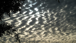
Somewhere between spotting a beach house for sale and the start of Tyagarah Nature Reserve, I glanced out towards Julian Rocks: there were bright silvery clouds as the rain eased. I was listening to my iPod (running aid), but softly this morning so I could still hear waves breaking. Suddenly, I felt energised in a way that's not easy to describe without sounding like a traveller in a camper in Jonson Street car park or a passenger on the happy bus to Nimbin. I wanted to do something somewhere between dancing and running, but successfully resisted the urge. It struck me that I was running in the most beautiful place imaginable. I became aware that the power of place is a force to be reckoned with, if not worthy of religious fervour. The endorphins were rushing: I felt radiant; exhilarated; delighted; at ease; at one; elemental.


I could have run for miles. I was soaked but didn't notice. I beamed at the few people we came across. It was the most enjoyable run I can ever remember. And the benefits lasted for days. Who needs drugs or churches?


Unfortunately, I can't carry a camera while I'm running. I'd be stopping all the time for one thing, which kind of defeats the object of the exercise. So I can't show you the tea-tree-stained waters of Belongil Creek or the gulls and terns resting at its mouth, or the Brahminy Kite sitting motionless and all-knowing. And you'll just have to take my word for the birdsong – from whipbirds whip-cracking to little darters twittering. In the otherwise perfect peace, it was hard imagine that bustling Byron was a 15-minute sprint away.


It might be unbelievable... It might just be fantastic*.


* © Chrissie Hynde


April 11, 2012

Bimblebox 2: April update

The problem is, when I lose myself in Queensland's landscape, as I did over the Easter long weekend, I get angry all over again about the great threat to pristine areas from resource development.


It's several weeks since I watched Bimblebox, the movie. In the meantime, Queenslanders have been to the polls and replaced the Labor government with the LNP. Just before voting day, Anna Bligh stated a commitment to protecting Bimblebox, the Nature Refuge, but by then she knew that her government was doomed to suffer a defeat on a scale not seen for decades. Now we wait to see how Campbell Newman's deficit-slashing measures will impact on environmental protection agencies, and whether conservation will be aided by his party's traditional loyalty to its country constituents or hampered by the influence of big-bucks backers*.


Many more people are now committed to keeping Bimblebox in the public eye than there were a couple of months ago. Hundreds have read my first post on the subject (see Bimblebox, March 2012); people in the street are writing letters to newspapers and lobbying pollies; and green activists are promoting discussion online or in print.


The more I've read, however, the more confused I've become about what is happening right now in terms of decision-making about the future of the Nature Refuge in the light of Waratah Coal's proposed China First project. So yesterday I called the Queensland Co-ordinator General's office to see if I could find out. The Co-ordinator General administers large-scale projects – whether they be concerned with infrastructure or social and economic development – and ensures that the environmental impact of such projects is managed properly. Increasingly of late, these projects have stemmed from demand for Queensland's vast resources, especially coal and coal-seam gas. The new Co-ordinator General appointed by Campbell Newman is Barry Broe, formerly a Brisbane City Council infrastructure manager.


A man took time to explain to me that, in effect, there are two Environmental Impact Statements being processed with regard to Waratah's plans for a massive open-pit coal mine to replace a remnant desert upland ecosystem – one at State and one at Federal level. Waratah have to go through Queensland's EIS procedures, while Canberra is involved in the matter of national environmental significance.


In the case of China First environmental issues, the Queensland Co-ordinator General offered to channel all public submissions – more than 1800 of them – which had to in by the end of last year. These were copied and sent to Canberra for the Federal Government to consider the issues that fall under its jurisdiction. Both State and Federal agencies are studying the submissions in order to produce an evaluation report. In theory, the two are not in conflict.


Following their conclusions, instructions will be sent to Waratah outlining any further environmental recommendations by the State. This stage is not far off, I was informed, but will take months rather than weeks. (The EIS is not just about Bimblebox but also a proposed rail line required to transport the coal to the coast for export.) Waratah will then have to address these issues.


I was told that, ultimately, nothing is protected from mining except a national park. Nature Refuge status affords the lowest level of protection against the will of those working within the requirements of Queensland's Mineral Resources Act. The Federal Minister for the Environment, Tony Burke, is empowered, however, to veto mining projects in favour of endangered species under the Environment Protection and Biodiversity Conservation Act. The National Parks Association of Queensland's submission lists 143 species of birds currently using Bimblebox, several of which are vulnerable or near-threatened. They describe the Refuge as an essential habitat for the endangered Black-throated Finch, and the area's 'conservation significance' for a number of mammal and reptile species, including koalas.


On 26 March the online Business Spectator reported that Clive Palmer had announced that the China First project's plan to export coal by 2014 was already a year behind schedule, thanks to the prevarication of the Bligh government. And this despite China First having been given 'significant project' status – which means a project is fast-tracked rather than getting bogged down in bureaucracy, and the State receives its tax revenue and royalties quicker.


At Easter I visited Conondale National Park and the Obi Obi Valley in the Sunshine Coast Hinterland. I walked through sun-spangled, ever-changing forest listening to Bell Miners 'tinking'; sat by babbling creeks and waterfalls; and almost got lost on deserted tracks through rolling open country. It was an uplifting experience.
Please write/email/tweet Tony Burke (http://www.tony
burke.com.au/get-in-touch). He needs to know how much you value Black-throated Finches. And he needs to know now.

* Waratah Coal's chairman, Clive Palmer, has donated at least $3 million to the LNP

This post was last updated on 13 April 2012


April 3, 2012

Edge of the world (Tas)

When I looked at the map and saw Edge of the World, just south of Albert River, I knew I had to go there. This is on Tasmania's west coast, beyond the end of the Bass Highway and at the limit of sealed roads. Wind careens over coastal scrub and waves have been gathering momentum over thousands of kilometres of ocean, all the way from Argentina.


We had been thinking we should see the Dismal Swamp – for the name alone – but weren't sure where it was. A slight detour off the Highway to Smithton's tourist information office put us straight: happily, it was on the way to the Edge of the World.


Dismal Swamp is described as a natural blackwood forest sinkhole, and is claimed to be the only one of its kind in the world. A sinkhole is a natural depression in the earth's surface formed by the chemical dissolving of carbonate bedrock, in this case dolomite. Forty metres deep, it has formed over thousands of years and supports 600 hectares of unique forest habitat. Blackwood is the tallest of the Wattles, and there are also Myrtle, Tea Tree, Tasmanian Tree Ferns and other ferns. From the rim of the sinkhole you can clearly see the sunken forest top below the surrounding vegetation.
You can get down to the forest floor by hurling yourself down 110 metres of enclosed slide. Not surprisingly, this creates a certain amount of noise as sliders scream and giggle their way down. I chose to walk sedately down a winding path, but then I'm just an old stick-in-the-swamp.


Once down, it is anything but dismal. Labyrinthine paths wend their way through beautifully backlit ferns and Tasmanian artists' installations inspired by swamp world. Inhabitants include pademelons, burrowing crayfish*, quolls, parrots, wrens and robins.
Blackwood was logged from the 1930s until the 1970s. A decade later there were calls to clear the forest for agricultural land which were opposed by environmentalists and sawmillers alike. The Dismal Swamp was declared a State forest in 1976, and two years later 100 hectares of it were made a Nature Reserve.
In northwest Tasmania you will hear a lot about the Tarkine, an area of wilderness bounded by the Arthur River to the north, the Pieman River to the south, the Murchison Highway to the east and the Indian Ocean to the west. Not only does the area include Australia's largest remaining area of Gondwanan temperate rainforest, it is the largest wilderness area dominated by rainforest. In addition, the Tarkine includes many other vegetation types, including eucalypt and dry sclerophyll forest, buttongrass moorland, wetland, grassland and sandy shorelines. It has wild rivers, caves, sand dunes, exposed mountains, significant Aboriginal archaeological sites and a huge variety of plants and animals, some of them rare, threatened or endangered.


You probably won't be surprised to learn that, despite such impressive variety and remoteness, the Tarkine has been under threat from logging and mining. There have been attempts to have it listed as a National Heritage Area, but Federal Environment Minister Tony Burke has been dithering in the face of mining proposals. There are also moves to award it National Park status. While many politicians acknowledge the area's importance and the necessity for conservation, the prospect of massive wealth from resource exploitation is difficult to resist, as is the case in Queensland.


At the end of the Bass Highway, turn left. The township of Arthur River, 14 kilometres south, feels remote and deserted. You can sail up the river aboard the George Robinson (below), into another world by all accounts.
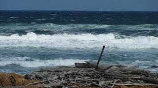
But we were bound for the Edge of this one. The beaches face the full onslaught of the Roaring Forties and are littered with timber debris, so much so that I began to wonder whether there had been a wreck recently. The breakers backed up a long way and white horses were visible to the horizon. Any shells had long been smashed to smithereens, and the seaweed resembled barbed wire. Some rocks looked like freshly wet rippled sand, and the surreal effect of this desolate, battered landscape was completed by a family of Black Swans trying to hunker down in the strong swell.
We had to drag ourselves away from the wild west of Tassie to head back to Stanley. On the way, we detoured to yet another Tasmanian lighthouse, on Bluff Hill Point. Built relatively recently, in 1982, to replace West Point Light further north, it has an elevation of 52 metres and a range of 30 kilometres. It is surrounded by the same wind-blown coastal scrub.
And then to Stanley, Tasmania's Tidiest Town, dominated by The Nut, a square-topped, steep-sided landform jutting out on a narrow isthmus. We could see it from kilometres back. This was once the lake of lava of a long-extinct volcano: today it provides a dramatic backdrop for Stanley's smart historic houses. You can walk up The Nut or take the chairlift, but it was late in the day when we arrived and we had barely enough time to have tea and admire the town's lovely buildings.
Settlement of the area dates from 1826: Stanley was named after the British Secretary of State for War and the Colonies, Lord (Edward-Smith) Stanley, in the 1830s and 40s. Always a port, Stanley's mainstays today are fishing and tourism. I wish we'd had longer.


This northwest tip of Tasmania has the cleanest air in the world, as monitored by the Cape Grim Baseline Air Pollution Station. The Roaring Forties rush in, untainted by passage over land, and when they produce rain, the purest water falls over the wilderness. This corner of a very different Australian island is perhaps most dissimilar of all.


Next, for the first time, we were headed for an inland destination and possibly Tasmania's most famous – Cradle Mountain in the Central Highlands.


* a specialised crayfish living in tunnels in mudbanks rather than flowing fresh water