September 27, 2014

Outback 2: the Dig Tree to Cunnamulla

There was uncertainty about how long it was going to take to drive from Innamincka to Cunnamulla. Google Maps said 15 hours, which I just didn't believe, considering a significant proportion of the route was sealed. But they don't normally get it wrong. A few people we'd asked predicted between 7 and 9 hours.

We wanted to visit Cullyamurra Waterhole, and the Dig Tree, both of which involved detours off the Adventure Way, while constantly monitoring diesel consumption…

It was a beautiful morning and Innamincka soon felt far behind. We were by the waterhole – turn off 7 km east of the I-word – for sun-up. Everything had a pink tinge. The only sounds were blathering Little Corellas and, at last, the kettle boiling for my life-restoring first cup of tea.
Explore Australia describe Cullyamurra as one of Australia's grandest waterholes. It has splendid Red Gums and loads of birds and fish, such as Lake Eyre Callop (Golden Perch), Catfish, Grunters and Yabbies. And it's part of my old favourite, of course – Cooper Creek. You can camp here and, unbelievably, launch a powerboat. Speed is restricted to under 10 knots, but that's probably loud enough to spoil the remarkable peace. The sun rose, and so did the Corellas, noisy as ever, even though there were pelicans still resting if no longer sleeping.
There be dingoes. And a smart toilet for such a remote place. 
We couldn't linger: the border and bitumen beckoned. We took our leave of Innamincka Regional Reserve, passing several trucks transporting oil and gas equipment.
The Reserve is massive, covering 13,545 square kilometres and encompassing dunes, gibber plains, river channels, flood plains, salt lakes and wetlands. The Cooper Creek system is listed as a Ramsar Wetland of International Importance*. It was used as a trade route and meeting place by Aborigine groups for thousands of years before being visited by European explorers in the 1840s. We had only passed through the Reserve, having moved on from Innamincka ahead of schedule and abandoned a plan to visit Coongie Lakes National Parks. The Lakes – which have wonderful names such as Toontoowaranie and Marrocutchanie – are also a Ramsar site, and attract more than 200 species of bird including many migrant waders. You win some, you lose some.
Back in Queensland, I hoped the list of natural resources on the sign above wasn't in order of priority: some hope. As we were now embarking on a slow meander back east, I needed to make the most of vast empty vistas.
The famous Dig Tree and Burke and Wills' Camp 65 was 13 kilometres back in the wrong direction, from just beyond the Burke and Wills Bridge over Cooper Creek, 27 km from the border. The Creek looked lush and verdant, in total contrast to the rest of the landscape.
In August 1860, 19 men, 26 camels, 23 horses and 6 wagons left Melbourne to cross the Australian continent from south to north. Progress across Victoria had been slow, and Robert Burke went ahead of a supply party at Menindee (on the Darling River in New South Wales), who were to follow on when conditions allowed. He took seven men, 16 camels and 19 horses with him on to Cooper Creek, where he established a depot at Camp 65. Burke was keen to press on further, despite it being the height of summer, and in December he and three others (John Wills, John King and Charley Gray) continued north for the Gulf of Carpenteria, leaving William Brahe in charge of the depot. Burke instructed Brahe to wait three months for his return before heading back south. 

The four were within tidal reach of the Gulf before being forced back by impenetrable mangroves. Conditions had deteriorated at Camp 65: there was illness and tensions with Aborigine neighbours. It was four months and one week after Burke's departure that Brahe made the decision to return to Menindee. He buried some provisions and a note and blazed an instruction to dig on a nearby tree. The evening of the day he left, some nine hours later, Burke, Wills and King (Gray had died on the way back from the Gulf) reached the camp. There followed a tragic chronology of events. Burke found Brahe's note and buried a new one, but he didn't change the blaze on the tree. The three continued to follow the Cooper downstream, heading for the aptly name Mount Hopeless. 

Brahe returned to the camp after a couple of weeks to see if Burke had returned, but could see no evidence of others having been there and didn't linger. Burke in the meantime was unable to cross the Strzelecki Desert after his camels died, and with provisions dwindling, the three men returned to Cooper Creek. They were largely surviving on nardoo, an aquatic fern they had seen Aborigines consuming. They were unaware of necessary preparation methods, however, and there is debate about the extent to which this diet hastened their deaths. They suffered from vitamin deficiency and malnutrition. Burke and Wills died by the Creek at the end of June 1861: King was looked after by Aborigines and survived. He was found by a relief expedition three months later.
There is masses of information at the Dig Tree. If you journey there in homage to an extraordinary yet doomed effort in an inhospitable land, allow time to stand and stare on the banks of the Cooper and imagine what it must have felt like to return to the deserted camp. Burke could hardly have expected Brahe still to be there, but he must have hoped against hope.

There is a lot of confusion about the several tree markings, when exactly they were blazed, and who made them. Make sure you pick up the leaflet from the 'stockade' with an annotated photo of the blazes. This will save you time wandering from tree to tree trying to spot markings that are no longer visible. Some have inevitably been obliterated as these mature Coolabahs have grown. The trees are believed to be more than 200 years old.

The leaflet also includes the first known photograph** of the Dig Tree, taken in 1898 by John Dick, a stockman and amateur wood carver. It includes the remains of a timber stockade built by Brahe to protect the camp's equipment and provisions, and later destroyed by flood waters. The banks of Cooper Creek have been eroded back since then. Dick made a couple of carvings on nearby trees, one of them an image of Burke's face, and these have added to confusion about who blazed what. If you want to know all the ins and outs of 'the mystery of the Dig Tree blazes', you'll have to go there.
We hastily returned to the main road: we had to put miles on the clock.
The Adventure Way is long. But slightly shorter than our paper map led me to believe. In the vicinity of Kookoona Creek, the road cut off a lengthy curve. On our GPS map on the iPad, the navigation marker headed off into completely empty space on the map. Since there are numerous gas fields not that far away, we had to conclude the mining company must have built a new road. Just when we were settled back on bitumen, however, there was an unsealed section and a familiar hazard.
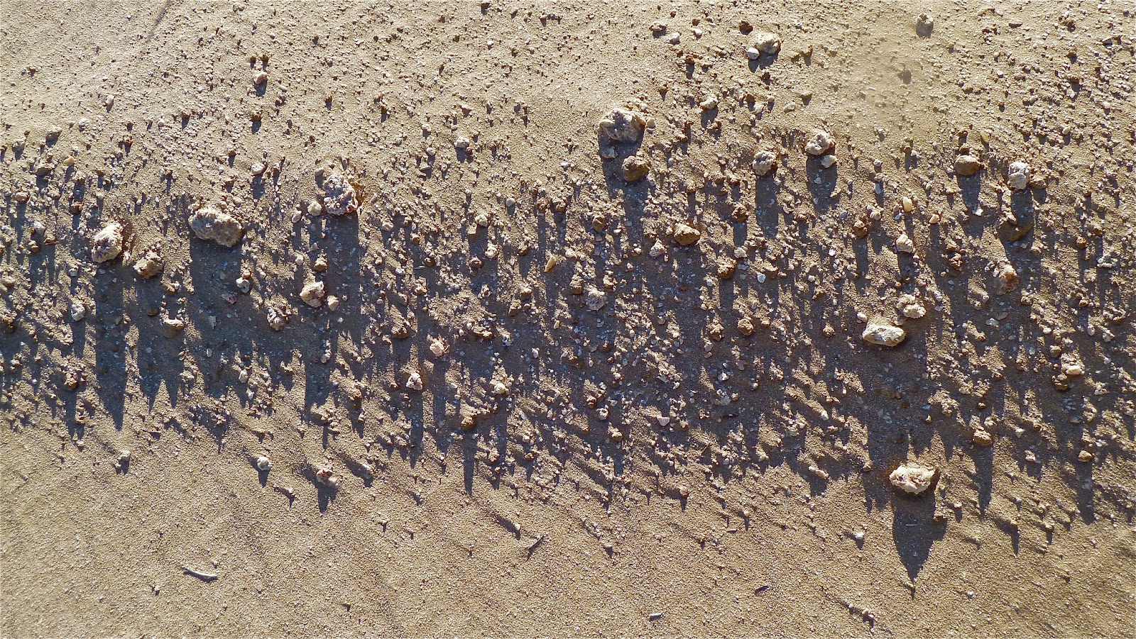
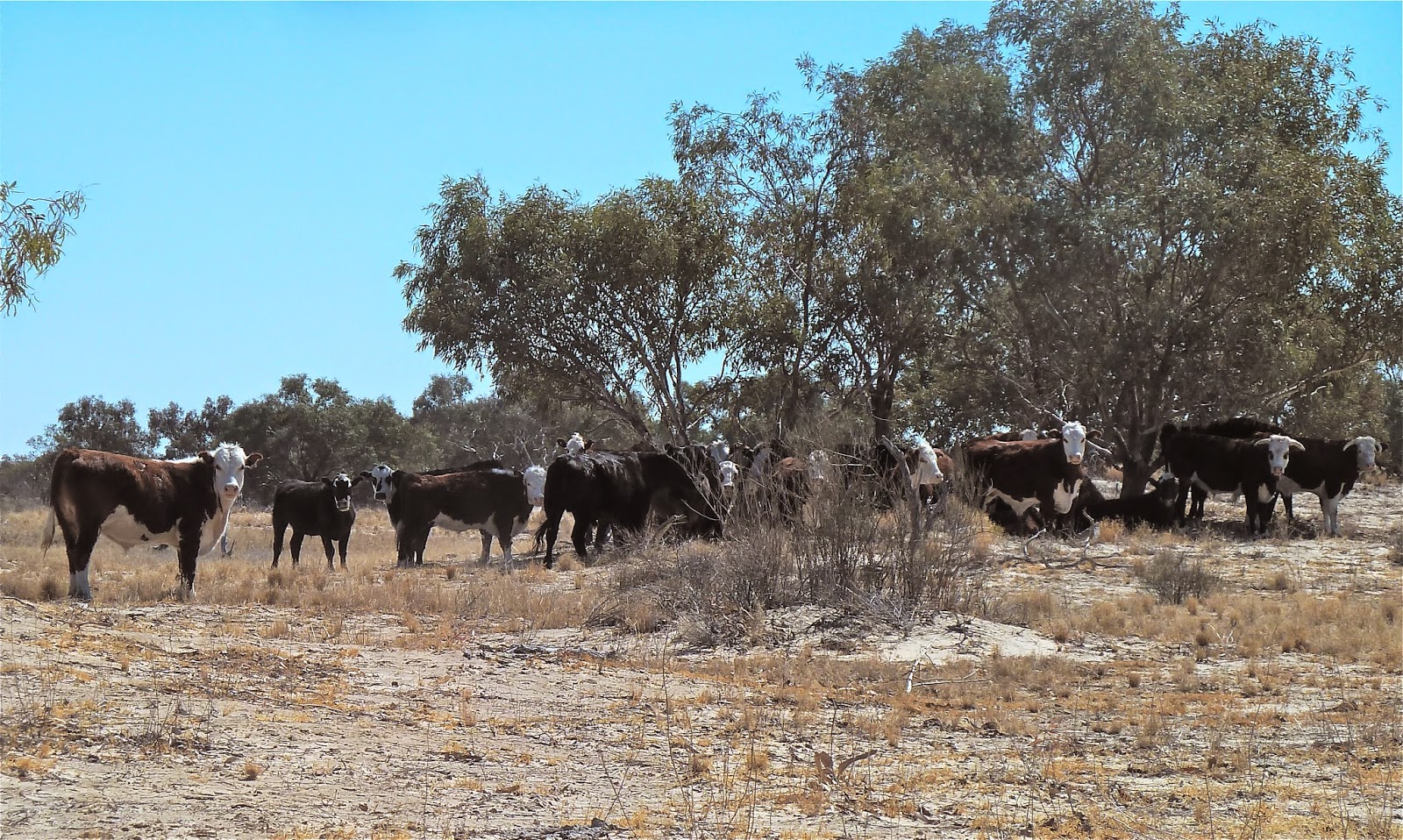
There were some engaging wildlife moments along the way.
 
Mama Emu couldn't scurry away from us quite so quickly with five babies at her feet. Just as cute was the echidna who thought that if he couldn't see us we couldn't see him.
Almost in the centre of the image below is a Black-fronted Dotterel, beside Cooper Creek. You may need to click to enlarge.
We had a late breakfast by one of the many Cooper channels about 100 kilometres west of Nockatunga (below); and we had lunch on the banks of the Bulloo at Thargo (below but one, two and three), having filled up with diesel and a certain amount of relief.
We were now far enough east to appreciate why there had been so many road closures following the downpour a few days previously in this part of the world, while we'd been dry as a desert in Birdsville.
We arrived in Cunnamulla before 5. Not the 15 hours from Innamincka, then? We were staying in the Club Boutique Hotel, always intended as a bit of a treat, but never more so than after our wretched Trading Post experience. We had stopped here for coffee last year on our way from Charleville to Kilcowera. Then the place was being renovated and not really open but we were still welcomed. Work is ongoing, especially in the garden, but we had a sizeable, pleasantly furnished room with a big comfy bed and great lighting, and a large bathroom with walk-in shower. We didn't go far to eat that night, about ten metres into the bar/restaurant. With good food and wine to finish the day, it was hard to imagine a bigger contrast from 24 hours previously. And there was a relaxing 'extra' day to look forward to.
http://www.ramsar.org/cda/en/ramsar-home/main/ramsar/1_4000_0__
** this image belongs to the Conrick Collection at the State Library of South Australia


September 25, 2014

'Terror doodles' and Team Idiot

Sometimes there's a fine line between helpful interest and nosiness.

When we were first finding our way around Brisbane – with puzzled looks on our faces, I'm sure – people would offer to give us directions. Famously, in the bush, if you've pulled over at the side of the road, other drivers will slow or stop to make sure you don't need assistance. This is good.

Not beating about the bush is an Aussie trait, too. Sometimes their questions are a tad direct. Alluding to my friend's 'swarthy complexion', one chap in the Outback made it clear he was talking ethnic origins rather than holiday glow.

Nosiness might be useful during the current terror drama season if it didn't also pose a risk to civil liberties, free speech and democracy. The other day came the ludicrous story that an interior designer from Melbourne was escorted off a flight bound for the Gold Coast after another passenger had reported seeing the word terrorism in his notebook… along with other words such as ice cream and fluffy bears. The Guardian termed the poor chap's scribbles 'terror doodles' – with tongue in cheek, of course.

Last week some 800 police burst into homes in Sydney and Brisbane in the dead of night. One man has since been charged with terrorism-related offences, but few other details have emerged. There was footage of the action, which the police provided to the MSM themselves. And stills for the newspapers. Isn't that a bid odd? Weren't they, shouldn't they have been, too busy worrying about the threat to be concerned about media coverage?

As Australia became more terror-focused, there was loose talk of beheadings on Australia's streets, which some people then used as an excuse to get into a tizzy about burkas and hijabs. The high-terror-alert provided the biggest excuses for Tony Abbott, however. It was a good job he wasn't distracted by the New York climate conference, wasn't it, so he was on hand to deal wi' trouble a' mill? And he could dodge indigenous issues even though he was camping in Arnhem Land. And he didn't have to negotiate with PUPs about the worst budget in living memory.

All this terror talk breeds high emotion and barely suppressed anger. I remarked to a friend on Facebook that I still feel uncomfortable in my local coffee shop queue alongside armed police on their morning tea break. I'm from a country where ordinary police do not carry hand guns or rifles. And I believe fewer people are shot dead as a result. There seems to me to be a greater tolerance here of the police shooting to kill rather than maim. My comment was misconstrued by other contributors. I am not faint-hearted about dealing with terrorists, but I do believe the West should at least debate the part its actions has played along their route to extremism.

One of the problems of the use of language is that the more you bandy about a word, the more people start to use it in quite inappropriate contexts. A rather unpleasant example of the National Party bit of the Coalition has recently crawled out of the woodwork in northern Queensland. George Christensen, member for Dawson, got all pink and indignant about the 'eco-terrorists' who campaign against the expansion of Abbot Point coal terminal. He got a bit carried away, unfortunately not literally, in Parliament:
The greatest terrorism threat in north Queensland, it is sad to say, comes from the extreme green movement… I am talking about… large, well funded, well organised eco-terrorists who use fear and blackmail to coerce government and the public into adopting their extreme political and ideological viewpoints… [They have] butchered the international tourism market for our greatest tourism attraction, not for the reef but for political ideology and threatened to kill off thousands more jobs in the resource industry… North Queenslanders will call out the gutless green grubs for the terrorists that they really are.
As he warmed to his theme, Christensen talked about extreme greens taking the Reef hostage and using it as a weapon, blah blah… you get the gist. It only needs a little chink of opportunity for right-wing bile to gush out; it's the same the world over. These miserable (not so) little people just can't help themselves. They keep their unpalatable beliefs under wraps until they espy an opportunity to stoke a fire they've been quietly tending.

Labor leader Bill Shorten was quite restrained I thought in describing Christensen as a headline hunting member of 'team idiot' – along with the Bernardis and Pynes on the government benches; those who almost willingly put feet in mouths in their haste to get the least politically correct bits of the party line across.
This post was last edited on 26 September 2014


September 22, 2014

Outback 2: Birdsville to Innamincka

The Birdsville Track: at last we were on one of Australia's great desert tracks, even if it was only for the first 123 kilometres.

That hadn't always been our intention, however. The initial plan was to drive east along the Birdsville Developmental Road, for 117 km towards Betoota, and then turn down the Cordillo Downs Track to Innamincka. I had read about how rough and stony this route was, especially through the Downs themselves, which is why we carried two spare tyres. The ladies at the Wirrarri Visitor Information Centre in Birdsville had convinced us otherwise, however. They claimed the Walkers Crossing Track would be quicker and pass through more varied landscapes. We were fairly easily convinced; but with hindsight, I'm not sure we did the right thing. I think I was receptive to being presented with a less challenging alternative. We later heard the Cordillo Downs Track has been much improved. The route we took was certainly interesting to start with, but it became more tedious as time went on, in terms of both its condition and surroundings.
ROUTE
Our new route took us down the Birdsville 'Outside' Track. The 'Inside' Track, across the Goyder Lagoon, was closed, and in any case would have taken us too far south to turn off to Walkers Crossing. It wasn't long before we crossed the South Australian border. We made good progress through stunningly empty country – with the usual liberal sprinkling of signs.
This sign was for those heading in the opposite direction, north to Birdsville.
What lived in here, we wondered.
By now we were in the Sturt Stony Desert. Charles Sturt was a British explorer who led expeditions into Australia's interior. On his third trip, in 1844, he was searching for an elusive vast saltwater lake, or inland sea. He passed close to where we were in August 1845, and, as he stood on a sand dune to get his bearings, he described a 'gloomy stone-clad plain' that was unlike any 'similar geographical feature [he had seen] in any other part of the world'. Much of the desert here is gibber: the small stones are the harder fragmented remains left after the breakdown of sandstone sheets that once covered the region. We travelled a stony road in a stony desert.
Suddenly, from nothing, there were flowering plants and succulents by the roadside. They may have been weeds, but they certainly added a dash of colour.
Being able to maintain a speed of around 80 kph on the mainly straight Birdsville Track was relatively easy going. It was a different story once we turned off – by less conventional signage, I might add. The Walkers Crossing Track was narrow in places and rutted. There were more interesting plants.
And then we were paralleling dunes.
At one point I spotted some cattle walking in a line towards a raised constructed watering hole. I can't remember exactly how I heard them; I was driving, so I must have stopped and put the window down. There was the loud squawky chattering of many Little Corellas, so I pulled off the track and we carefully walked up the slope of the retaining wall. There were hundreds of birds.
Galahs were interspersed with the Corellas. Eventually they took to the air. It's one of the things I love about the Outback: birds in these numbers; just wonderful.
Walkers Crossing Track was getting rougher and more uncomfortable. We kept stopping for breaks from the bone-shaking: to photograph beautiful wattles in flower, cows, pleasing trees, dead trees, anything.
 
Eventually we came to the crossing itself. By now we had dropped down from the Sturt Stony Desert to the flood plain of the northern overflow of Cooper Creek, and we'd entered the Innamincka Regional Reserve. I have learned from offroaders' chat rooms that Walkers Crossing Track was closed for an extensive period following flooding in 2011. There is a suggestion that an old bridge was dismantled when the Track became a Public Access Route (PAR) to avoid repeated maintenance after frequent inundation. A PAR is not part of the South Australian main road network but allows public access over pastoral land without having to obtain permission. Such tracks are unimproved and not surfaced and are intended for 4WD vehicles in dry conditions only. Walkers Crossing Track provides access from the Strzelecki Track to the Birdsville Track without leaving South Australia.

Now, however, there is a new bridge over the Creek. The Track continues through Santos gas and oil fields as well as a private cattle property, and the crossing has been improved for access to wells.
It seems fair that if oil and gas companies are going to litter the landscape with their operations – in this instance making bleak-looking country even bleaker – then they should be made to improve roads for local as well as their own needs, and this should be a condition upon their approval. We were allowed to use a couple of straight well-access stretches on which we were able to glide a lot more comfortably at 80 kph, making better progress. Then we were made to go round a loop on a bad surface before returning to the improved road. This was near Fly Lake: so beware, and don't turn left, keep going on the 'good' stuff. 
By the time we reached Fifteen Mile Track and the last 50 kilometres or so to Innamincka, we wanted to stop bumping along and reach our destination. We couldn't be tempted by any of the below, even the most intriguing. (A few apostrophes might have helped.) And there was the added danger of bull dust holes. These look like slight depressions filled with soft folds of sand and wonky tyre tracks. You need to approach all such areas with caution in case the hole is deceptively deep and has rock-hard edges, or is even filled with debris.
The picture above is the last photograph I took that day: no welcome sign to Innamincki; iconic buildings; roosting birds. As we drove into town, I was reminded of John Steinbeck's descriptions of the dust bowl in Thirties America. As I got out of the car, my dust tolerance level wasn't high: I was slightly uneasy. 

We were booked into Innamincka Trading Post for two nights. I had tried to get a room at the Innamincka Hotel, run by the same company as the Birdsville Hotel, but they were booked out to people about to make the Big Burke & Wills Trek. We were checked in by a fairly humourless man, who didn't speed up when a queue formed behind me in the shop. I paid for both nights and form-filled. I wasn't expecting luxury, but for less than $140 a night we'd stayed in much nicer places. There were two rooms in the 'cabin', each with twin beds that almost filled the space. There was a television in each (which we didn't need) but there was no bedside table or light, no fridge, no kettle or cups. It was grimly basic and the light was appalling. The only side light over one bed in each area had been removed, leaving holes, and the overhead light was utilitarian and dim. We couldn't have read after dark. It was not a place to relax in after a hard day's drive. A shipping container might at lease have been cosy.

I returned to the shop and asked a pleasant-enough young woman behind the counter if it was possible to borrow a bedside light of some kind. Immediately an old crone appeared out of the back and took over. 'No', she said. And that was that. 

We went and sat in the Hotel, where the staff were welcoming and helpful. Innamincka was the first town we'd been in with no mobile coverage, but they let us use a phone in reception to call our next destination, in Cunnamulla, to see if our room was available a day earlier. It was. Over delicious food and a bottle of wine we calculated whether or not we could make it to the first available diesel back in Queensland. The only supply in Innamincka was at The Trading Post, and we weren't going to give them another cent. It would be tight, but with our spare can of fuel, we should be able to make it to Thargomindah. 

No Coongie Lakes National Park; no Hot Rocks Power Station. We were out of Innamincka.

Should you ever find yourself in this town, and the Hotel is fully booked or the campsite packed out, sleep in your car. I guarantee you will not be as cold or uncomfortable as I was that night. Do not consider The Trading Post for an instant. My friend took the photo below, and I snapped some pictures at first light, just for the record, before we crept out of town. We had difficulty finding the 'Adventure Way': there were no signs to anywhere in Queensland, just 29 kilometres up the road. A truckie gave us directions in the end. I couldn't get out of Innamincka quick enough.