April 30, 2015

BTF?

Courtesy of Kim Maute, BTFRT*
The Black-throated Finch is particular about where it lives. It feeds on grass seeds, but not all varieties. The grasses should be of the clumping variety, and not grow too tall. BTF likes to be able to access all around the clump, picking up seeds off the ground; and tall grasses prevent the bird from seeing approaching predators. It won't go into thick grass. There has to be water nearby; and woodland has to be open so BTF can see and reach the sky. Oh, and it doesn't like shrubs: it's the access factor again. As long as it's got seeds, water, and nesting ledges, then BTF won't go far. It's described as sedentary, which means it's not migratory. It will usually range between three and five kilometres, unless it's dry or the breeding season, in which case BTF might have to venture further for food and water.

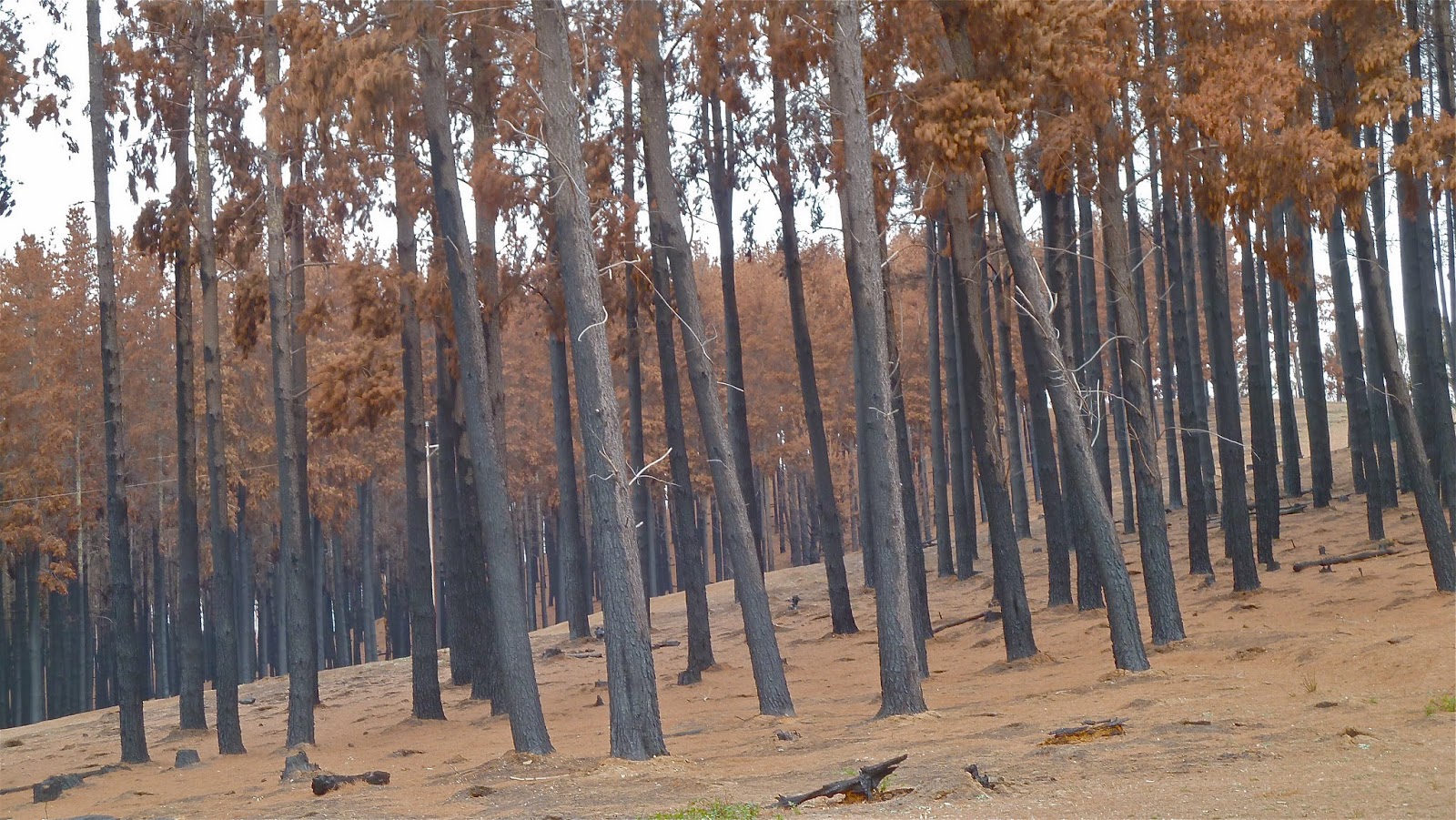
BTF builds nests in hollow branches or tree forks, but may also use tall grass or even old nests that once belonged to Babblers or Diamond Firetails. BTF nests are made of grass, and are oval-shaped with a spout-like entrance; and some are built for roosting rather than breeding. The bird is partial to the Silver-Leafed Ironbark for nesting, but this tree is slow growing, taking 200 years to reach maturity since it only grows significantly in wet La NiƱa years. (Difficult to offset, right?)

Four years of study has been done since Adani's Carmichael mine in the Galilee Basin was first proposed in 2010. Since an Environmental Impact Statement was produced in 2012, the significance of the area as the last bastion of the Black-throated Finch (southern) has become more apparent. A James Cook University PhD student, Stanley Tang, observed 400 BTFs at Ten Mile Bore on Moray Downs property (within the mine site) in September 2013, and this is now acknowledged to be the main surviving population** of BTF. This core population is essential for the species' continued survival, and it services surrounding smaller satellite populations. An endangered species, BTF had to be impact-assessed under the Environment Protection and Biodiversity Conservation Act.

How do we know whether there are any BTF there at all? Or how many? Surveying techniques for locating birds are many and various. You can do a waterhole watch, preferably at sun-up or late afternoon; walk a transect for a few hours; or drive a transect (BTF often uses grasses alongside tracks); and nest spot in likely woodland. You can sit for hours, or walk for weeks and never see what you're looking for. Or you can be in the right spot at the right moment when a large flock comes to drink.

Both expert witnesses in the Land Court agreed that there was a paucity of baseline data for both impact statements and potential offsetting; that field surveys could have been better managed; and that ecological equivalence methodology was not sufficiently robust. They were also in agreement about the degree of harm that would be done to this critical BTF habitat were it to be cleared or disturbed. BTF will be dispersed, with these possible outcomes:
1 BTF will not find a suitable replacement habitat and will die
2 BTF will find a suitable habitat already occupied by BTFs and without the carrying capacity for more, so the birds will be further displaced or will die
3 BTF will find a suitable habitat already occupied by BTFs, the latter of which will be replaced and dispersed
4 BTF will find a suitable habitat with no or few other BTFs so there will be capacity for a larger population.
Number 4 has to happen if there is to be no net loss of ecological value. Unless there is suitable BTF habitat close by, then there is a higher probability of 1 to 3.

Regional ecosystem mapping was use to identify possible BTF habitat within assessment units of eucalypt woodland and mixed species grassland, and to assess potential offset areas. BTF doesn't like Brigalow, Lancewood or Gidgee; or Buffel grass. A thick tangled understorey doesn't suit, either. The birds' specific preferences were not mapped. So, eight species of grass were searched for, even though BTF probably has four favourites. A broad analysis was not good enough for such an important BTF population. Ecologist Dr Lindsay Agnew (for Coast and Country) was surprised that Adani's habitat specialist hadn't consulted a biologist for a project of this significance.

Given that BTF is bound to be adversely impacted, a Biodiversity Offset Strategy (BOS) has to be implemented. Surely Adani's BOS has be revised, following further research. Even if you accept the principle of offsetting to compensate for landscape obliterated and species dispersed, there are still significant problems with such a plan:
1 Time lags. In the Carmichael BOS as it currently stands, offsetting management (removing cattle, removing ferals, controlling weeds (Buffel), providing water sources) commences only a couple of months before the first phase of mining. If sites aren't prepared for BTFs to take up residence, then the birds' survival will be severely compromised.
2 Security. An offset area must be legally secured for the duration of the mine. Nature Refuge status was mentioned, for example. But that's a joke. Just 100 kilometres or so southwest of Carmichael is Bimblebox Nature Refuge, a high-conservation-value site that is currently under threat from Waratah Coal's plans to mine. If a Carmichael offset area is outside this mining lease but within another, then it's feasible another mining company would be required to offset the offset at some point, which is ludicrous.
3 Management review. This takes place a year after the mine has been operational. BTF could be long dead in its offset area – if, in reality, it ever went there.

During three absorbing days of BTF evidence and cross-examination last week, one extraordinary claim stood out. Adani's lawyer argued, and was backed up, if a tad reluctantly, by his ecologist expert witness, that the Carmichael mine would be good for the Black-throated Finch. In a no-mine scenario, the land would continue to be degraded in various ways and the southern sub-species of BTF would be further squeezed out of its Central Queensland range. With offset areas necessitated by the mine, however, the species' survival would be managed and much more likely in an 'additionalised'† habitat.

The experts knew of no example of the successful offsetting of a bird in this way.

The demise of the southern species of BTF has been described as 'death by 1000 cuts'. Anthropogenic impact, pastoral practices, the invasion of exotic plants and feral animals have all taken their toll, gradually reducing BTF's range to this main pocket that now lies in the path of probably the most destructive force of all. At times during the case I dared to hope that something must and will be done to save BTF, and that it will be the vanguard of a new and powerful government commitment to protect Australia's landscape and biodiversity. But there usually follows a reality check in the form of market forces and royalties and reduction of state debt; otherwise known as greed.

We shall see.

* Black-throated Finch Recovery Team. See http://www.blackthroatedfinch.com for how to help
** previously the largest population was believed to be one near Townsville
in biodiversity offsetting the term additionality describes a conservation outcome that is demonstrably new and additional and would not have resulted without the offset


April 28, 2015

Waxing lyrical

                                        courtesy of EDO QLD
As luck would have it, two of the species threatened by Adani's Carmichael mine in the Galilee Basin don't have the simplest of names, especially for repeating often during cross-examination in the Land Court. The Black-throated Finch has long been affectionately known as BTF; and now, thanks to familiarity on the part of Coast and Country's Senior Counsel, as well as in true Aussie linguistic style, the Waxy Cabbage Palm (above) has become 'Waxie'.

Queensland's Waxy Cabbage Palms stand out dramatically in a semi-arid region. It is a single-trunked, fan-leaved palm that can grow up to 20 metres tall. The lower surface of the leaf blade is covered in a thick white wax. The Palm lives in precious few colonies on 'benches' alongside streams and gullies in the Burdekin River catchment: the streams are often braided (multi-channelled). The habitat is described as open woodland along sandy water courses that may be in flow for only part of the year, and by permanent pools adjacent to flood plains. Waxies like alluvial soils derived from granite.

The Carmichael River Waxie population is the most significant population in the world, and is considered necessary for the longterm survival of the species. It is a shallow-rooted plant, and how it might cope with a massive mine down the road is largely dependent on hydrogeology – and a huge dose of speculation. The base flow* of the Carmichael River is derived from the Doongmabulla Springs. If they dry up, the River's flow will be seriously disrupted and the Waxies, a classic drought-avoiding species, may die. Already classed as vulnerable**, the Waxy Cabbage Palm is at greater risk than ever.

What has become obvious during this case is that, in this arid region of Central Queensland, knowledge about a whole range of subjects is, at best, scanty. That knowledge has been increased by the findings of experts-in-their-field engaged either by Adani or Land Services of Coast and Country. In each case, the experts report singly, then hold a conclave that results in a joint report for the Court's purposes. The Environmental Impact Statement for the mine was produced long before these experts put their heads together.

But there is no irrefutable evidence for why the Waxies are where they are. The fact that they occur by the Carmichael River downstream of the Doongmabulla Springs but not upstream suggests a hydrogeological correlation.

There remain 'knowledge gaps' in both the assessment of the potential impacts of the mine on its surroundings and the offsetting measures proposed by Adani for the last-resort scenario, if environmental harm cannot be avoided or minimised to an acceptable level. Inadequate knowledge hinders the environmental valuation of the site, reduces an accurate calculation of the risk of harm, and increases doubt about the capacity of offsets to prevent a net loss of biodiversity.

Of even greater concern is that the Biodiversity Offset Strategy (BOS) stipulates that monitoring and mitigation – the backbone of offset management – kick off only just before, or coincident with, phase one of the mine works. There was a kind of lightbulb moment – as the Court was considering the plight of the Black-throated Finch – after numerous references by Adani's expert witnesses to 'not at this stage', or measures being put in place 'at a later stage' when asked about an offsetting programme: LSCC's Counsel, and the rest of those of us in the public gallery, became aware of the reason for the delaying tactics. The costs of extensive research into how Waxies might fare in an offset area in reality, desirable as that might be before Adani gets its licence to mine, would add considerably to an already sizeable outlay. I would suggest, in fact, that the whole biodiversity offsetting management procedure is geared for the convenience of resource exploiting companies rather than the protection of compromised ecosystems.

We know that the water table where the Waxies grow densely is at about three metres below the surface. Since the Waxies thrive, their roots must reach at least that far. (For comparison, eucalypt roots extend 30 metres down.) Offset strategies are even more assumption-based than experts' reports. If there are smaller Waxie populations away from the Carmichael River, on Cabbage Tree Creek for example, it is assumed by the BOS that others could be accommodated there. Translocation of seedlings or juveniles wasn't mentioned specifically, but how else could they make the move? The Waxy Cabbage Palm regenerates episodically: seedlings germinate after rainfall or surface flow during flooding.

Field botanist and ecologist Dr Mike Olsen, for Coast and Country, was scathing about offsetting, however. He has 40 years of landscape assessment and management to his name, particularly with reference to Queensland's fauna and flora. He pronounced: 'Offsetting defies the basic principles of population biology'; adding, 'the Australian landscape is littered with offsetting failures'. He sees no evidence that the proposed offset areas have any capacity for Waxie population growth, and neither does he acknowledge that existing populations are being negatively impacted by weeds, feral pigs, cattle and bush fires, the management of which is proposed for the improvement of the habitat value of the offset areas.

Dr Olsen explained a bit more about population biology: that a healthy, well-established plant community functions at an optimum level within its ecological niche. If you introduce more trees, for example, optimum conditions will gradually re-establish themselves, despite anyone's best efforts to alter the landscape in one way or another. Some trees will die off; or seedlings will not develop. Nature knows best, you see. (These are my words, not Dr Olsen's.)

At times in Court, when an acknowledged, even world-renowned, expert faces a barrage of nitpicking questions, not designed to enlighten but to undermine, to defend the indefensible in fact, it makes you seriously question an approvals process based on conjecture rather than research, and a legal system that can only recommend rather ensure the protection of Australia's rich biodiversity.

* the dry-weather flow in a stream or river resulting from groundwater seepage and not runoff from precipitation
** A vulnerable species has to have an environmental impact assessment under the Commonwealth Environment Protection and Biodiversity Conservation Act (1999)
This post was last edited on 29 April 2015


April 25, 2015

Hope springs eternal

Until Dr Rod Fensham took the stand in the Land Court last friday, I could never have imagined being captivated by spring ecology. The Associate Professor's (School of Biological Sciences, UQ) enthusiasm was clear to all, and infectious. He is recognised as the world's pre-eminent expert on Australian springs, and was invited by Senior Counsel Holt to describe how, during 25 years of quantitative field ecology, he had developed his knowledge of springs.

And so we learned that although two-thirds of the Great Artesian Basin lies beneath Queensland, little was known about the springs around the Basin's eastern edge before his relatively recent research. Many springs are now extinct, and with them will have disappeared plant and animal species that have never even been identified. Today, springs are still under threat of drawdown as a result of development of various kinds.

Springs were an important driver of pastoral settlement: they were a signpost to what might lie beneath the ground. From the late decades of the 19th century onwards more and more wells were sunk to water arid regions, and the subsequent reduction in water pressure meant the demise of many springs.

Springs have been historically significant the world over: think North African oases in an otherwise barren landscape. There are four types: those that supply waterholes such as billabongs; those issuing out of a hole in rock (important refreshment sources for Aborigines); discharge springs, which flow under pressure; and gravity springs, formed by rainwater percolating through rock from higher elevations.

Described as cradles of evolution, springs have made an important contribution to the diversity of life. They have permitted unique species to develop. Queensland has springs that are the only ones of their type on the planet. Yet some critical questions about springs are not ecological but hydrogeological. It is important to know how they function, specifically their source aquifers. The springs in the Doongmabulla complex are both discharge and gravity, but not all have been characterised conclusively. It is even arguable precisely how many springs there are in the group. They are at least 1,000 years old but probably much older still.

The Doongmabulla Springs are a few kilometres west of the Carmichael site, but are a key feature of the mine's potential environmental impact assessment as a result of disagreement among expert hydrogeologists identifying the source aquifer. If it is the same rock strata as the one in which the coal seams are located then that will be dewatered and the Springs will cease to exist (see also Leaky aquitards, April 2015).

This permanent artesian fresh-water spring complex is listed in the Directory of Important Wetlands. There are four groups – Joshua, Moses, Little Moses and Surprise – that extend over about 10 hectares. Both expert witnesses agreed that the Springs have 'exceptional ecological value', reflecting the endemic species found in the complex, which is classed as a Threatened Ecological Community (TEC). Six species are only found here. What were described as 'exotic aquatic animals and plants' – and I believe the meaning of exotic here to be strikingly different or unusual rather than foreign – are found in the Springs and their associated wetlands. Among the plants there is Salt Pipewort and Blue Devil, the rarest, and others that are so uncommon they don't have common names; and there are molluscs, unique water mites and even small fish.

Spring sources have been substantially transformed by human use. Cattle and feral pigs trample plant species, although it is now believed that plants recover from this quicker than was first thought. There is a world of difference, however, between the impacts of trampling and dewatering.

The first mention of offsetting in the Carmichael case was made in connection with the threat to springs and their ecology. It would involve 'enhancing' existing springs or the reversal of extinct springs in the area. Even Adani's spring ecologist had to admit that there are no examples of translocated endemic species doing well in artificially created springs. For one thing, the chemistry of spring water is critical for land species.

A key problem with offsetting revealed during this case was the fact that detailed monitoring and mitigation will only be done once approval is finalised and the mine is up and running, which may well be too late for impacted springs and endemic species. Also, there is the 'additionality' condition. The offset has to be bigger than the existing feature. I find it hard to imagine how exceptional ecological value could be replicated, let alone improved. And, another question for the proponents of offsetting: do offsets end with the termination of the Environmental Authority? So much uncertainty; so many questions yet to be answered adequately.

I have mentioned the chemical composition of springs. Chemical signatures could be used to compare Doongmabulla Spring water with groundwater samples from the coal-seam-bearing Colinlea and the Clematis/Dunda Beds above the less permeable Rewan formation. This might be useful in identifying the Springs' source. There are samples available from the Colinlea, and there is some similarity with the springwater. There are few bores in the Clematis/Dundas, however, and the best belong to Adani. Unfortunately, a request by
Dr Fensham for a sample for his ongoing Lake Eyre Basin Springs Assessment project was politely declined.

The photograph at the top of the page is of Moses 3 Lagoon, part of the Doongmabulla Spring complex, and fed by a spring from beneath the Lagoon. Courtesy of Land Services of Coast and Country, 2014


April 19, 2015

A model of imperfection

If you're planning to excavate Australia's biggest coal mine in the middle of an arid region in Central Queensland, you must obtain a mining lease (under the Mineral Resources Act), an environmental authority (under the Environmental Protection Act) and approval under the Environment Protection and Biodiversity Conservation Act. The approvals process includes a Groundwater Impact Assessment, which is part of an Environmental Impact Statement (EIS). This is because mining involves the dewatering of the rock strata in which coal seams occur, and the use of large volumes of water in the production of coal, for washing and dust suppression for instance.

This week in the Land Court, the Adani Mining Pty Ltd vs Land Services of Coast and Country (LSCC) case looked in detail at Adani's groundwater model assessing the impact of the Carmichael mine's drawdown on regional water resources, required by government regulators for a project of this size.

There are guidelines for modellers. There used to be three classes of models based on low, medium and high degrees of complexity. But this classification has been redefined in terms of levels of confidence in the objective, in particular in this case the assessment of the potential impacts of drawdown on nearby groups of springs. What this boils down to is whether or not the clay Rewan formation (see image at top of page), a largely impermeable stratum, offers sufficient protection for aquifers (Clematis sandstone and Dunda Beds) above the Rewan that supply the springs, wells and bores used by landholders, from the dewatering of the coal-bearing strata (Colinlea sandstone) beneath the Rewan.

Unsurprisingly, what you get out of a model is dependent on what you put in, and how the modeller tweaks the parameters.

A numerical model is based on a conceptual model. Physical attributes of the latter have to be formulated in mathematical terms and used to build a myriad three-dimensional cells. Certain simplifying assumptions have to be made in this process in order to enable values to be inputted; for example, that the density of groundwater is constant. The modeller adjusts the features of cells to replicate actual measurements where they exist. Key features in this model were recharge rates; hydraulic conductivity and hydraulic head (the resting level of groundwater, or the height to which water will rise in a bore); and the storage parameters of aquifers. The boundaries on the ground that confine the model were also significant.

LSCC's hydrogeologist Dr Webb had already explained to the Court in his conceptual hydrogeological model that faults might be present in the otherwise low-conductivity Rewan, through which water might flow between the Colinlea and the Clematis. No faults were included in the model, however. Adani's modelling expert argued that, since there is no evidence of faults, they should rightly not have been included because where would you put them? His opposite number suggested that faults should be in the model if only to disprove their effects. They both agreed that hydraulic conductivity values seemed to be too low, but disputed the head values. There was particular concern that the positioning of the western boundary would reduce the likelihood in the model's results of impact on the Great Artesian Basin (GAB).

I felt in the Alpha case in 2013, and again in this one, that the GAB is the elephant in the courtroom. It's overwhelming hydrogeological presence and its importance hydraulically for farming and settlement in vast swathes of central and eastern Australia should ensure that it cannot be ignored. All proposed development projects should, in my humble opinion, have to pay specific attention to this feature in approval applications.

But back to modelling. Even greater anxiety was expressed about the absence of springs in the model. Adani's expert explained that springs were in the 'too difficult' box; that they were too computationally intense, though not impossible to include. The survival or not of the unique Doongmabulla Spring complex – just 8 kilometres from the mine site – had occupied the court for days, so perhaps the modellers' brief should have been more specific.

The degree to which a groundwater model reflects a real situation depends on the accuracy of the input data and the parameters – the features or measurable factors that define the system. Once data has been inputted, you have a base model. Parameter Estimation (PEST) software can be combined with the intuition of an experienced modeller. Subsequently, inputters graduate a model's parameters to allow for irregularities. Model calibration is a process of adjustment of parameters within acceptable margins of uncertainty about the system to obtain the most likely potential outcomes that satisfy predetermined criteria.

The model produced in this case was a steady state model: that is, it presumed properties remained unchanged through time. The alternative, transient calibrations, would have allowed for variations in rainfall, for example, or mining activity. Both modelling experts agreed this would have been desirable.

The model outcomes were analysed in a report for the regulators who ultimately decide whether or not the Carmichael mine proceeds. That report was peer reviewed. The experts debated at length in Court the report's omissions, inaccuracies and misconceptions, not to mention flaws in the modelling process itself. There were underlying concerns about the lack of on-the-ground data; the absence of the 'linear superposition' of potential effects on the GAB; the range of the orders of magnitude used in sensitivity analysis; and the limitless number of particular values in an uncertainty analysis, which elicited the rather disturbing question from Senior Counsel Holt, 'Does this mean all models are wrong?'

There certainly seemed to be a pervading impression that no model can provide anything better than a best estimate.

Perhaps I am wary of an approvals methodology that does not err on the side of caution if there is sizeable doubt about the conservation of water resources.

Queensland's Co-ordinator General, who recommends – on the basis of the EIS and subsequent SEIS (Supplementary Environmental Impact Statement) – to the relevant state government ministers whether or not they should grant approvals to mining proponents, received advice from the Independent Expert Scientific Committee (IESC) on Coal Seam Gas and Large Coal Mining Development. This is what they said of Adani's initial groundwater model:
The Committee is not confident that the proponent's groundwater model will be able to accurately predict responses to perturbation of the groundwater system arising from the proposed mine. The Committee does not have confidence in the model's predictions for the potential groundwater impacts to the Doongmabulla and Mellaluka Spring Complexes and the Carmichael River.
I rest my case.
The image at the top of the page is Dr John Webb's conceptual geological model used in the Groundwater Modelling Report for the Carmichael Mine


April 12, 2015

Wining in the Adelaide Hills (and the Barossa)

If you're a wine-lover in Australia, there are several Meccas where you should pay your respects. There's the Margaret River in WA; the Adelaide Hills and the Barossa in South Australia; the Yarra Valley in Victoria; the Hunter Valley in New South Wales; and, if you head north up the New England Highway from the Hunter you'll pass through the Granite Belt in Queensland. Some producers from the traditional regions tend to wrinkle their noses at the idea of decent wines being made in semi-tropical Queensland, but there's a few can hold their own.

We ticked the last of these regions off over Easter. We hadn't had any plans until a couple of weeks beforehand: we suddenly got the idea to head for the Hills.

Adelaide is roughly the same flying time from Brisbane as Melbourne, about two hours 20. The skies were gloriously clear over southern Australia, and I would have appreciated some information from our Qantas pilot about the route. Did we fly over Broken Hill or the Flinders Ranges, for example? Fortunately we got talking to the chap next to us, who pointed out the meandering Murray River, and gave us some travel tips for the next few days. He was an Adelaide lad who worked in the coal seam gas industry in Roma (QLD) and was returning home for time off. He told us some worrying things about water, but, hey, this is a nice travel piece, not an environmental rant.
One of the things he recommended was a slight detour off the South Eastern Highway to look down on Adelaide from Mount Lofty, spotted and named by English navigator Matthew Flinders in 1802 but not explored by Europeans for another 35 years. There's a long climb to the east of the plain on which Adelaide stands. At the top, it's about three kilometres to Mount Lofty Summit, where there were many people on this fine day. We could clearly see the square mile of Adelaide's CBD and the green belt surrounding it. The idea of indignant Southern Brown Bandicoots made us laugh. We didn't see any, unfortunately.
Those European explorers were in fact timber-getters lured by giant stringybark gums. What we see today is regrowth, albeit the natural vegetation of the area. Please take me to a region of original vegetation on mainland Australia that hasn't been cleared or messed with.

The Adelaide Hills are about 45 minutes from the city, so, on leaving Mount Lofty, we were soon at our home for the next three days, The Villa, part of Adelaide Hills Country Cottages, near Oakwood, which is near Balhannah. Glorious autumn colours were everywhere, and surrounding our beautiful house. On one side there was a vineyard, and on the other a view across the Hills.
Later we went into Hahndorf, the nearest small town. We'd noticed along the way from Adelaide that most cafes, shops and pubs were closed. It was Good Friday of course, and despite Australia claiming to be a secular society, religions still hold sway. There are churches everywhere, and even though a minority attends regularly, there is a continued observance of rituals that are out of kilter with contemporary life. We are encouraged to travel and visit places at Easter, the last holiday weekend for months, but many basic providers are closed for business. And what's with the in-your-face propaganda by the roadside? It may occasionally be faintly amusing, if you like puns, but usually not. Here's one we passed on our way back from the Barossa.
Hahndorf was buzzing, however: everybody was here trying to get a meal. This is Australia's oldest surviving German settlement: Lutheran migrants arrived here at the end of 1838 from what was then Prussia. German influence is still strong and evident along the pretty, if twee, main street, which was a riot of colour.
Kitchenalia?
But surely not into QLD?
We had read about the bakery, and bee stings in particular had been recommended. They were hard to come by unless you were early or had pre-ordered, which we did in the end. 'Slice or slab?' we were asked. Didn't have a clue, but we ended up with three slices each. It is almond-slice-topped sponge with cream in the middle, but not tasteless, pappy cream like you get with a Devonshire tea here; overall, not too sweet and rather pleasant. This was all that was left by the time I remembered to photograph it.
The more renowned Barossa wine region is just up the road. Saturday was Barossa day. It was cloudy and we didn't find an open coffee shop until nearly lunchtime. We went via Lenswood, where there were apples galore, and Lobethal, which was grim, then up to Gumeracha, which sounds like an oath. It is the home of a South Australia icon, the world's biggest rocking horse. I was able to buy a mini version from The Toy Factory to add to my collection.
Great corrugated iron, however
Just west of Gumeracha is Chain of Ponds. It used also to be the name of a township further west that unfortunately was drowned by the creation of Millbrook Reservoir. The winery narrowly escaped a serious bush fire in January, and there were whole plantations of burnt trees, but in the midst of devastation the gum trees were sprouting new growth from top to bottom. Chains of Ponds buys in its grapes from local growers otherwise smoke taint would have cost them dear. We tasted several wines and bought a couple of bottles for a box to send home. (I love the name, but please fix the O.)
The landscape was still hilly, and patterned with vines, the distinctive grey-brown earth contrasting nicely with the turning leaves. Finally, in Williamstown, there was a coffee shop open. We were now in the Barossa, and famous names appeared.
At Tanunda we collected information from the visitor centre and made a Journey in Human Landscape at the Barossa Regional Gallery. And we learned about the Scarecrow Trail, part of the 2015 Barossa Vintage Festival. First we drove to Maggie Beer's Farm Shop for provisions for supper that night. It was a well-designed, lovely place but completely rammed. We grabbed some food and got out of there, having first looked at the turtles in the lake.
While we were trying to find Whistler Wines, the recommendation of a big Sauvignon Blanc fan and friend of mine who lived in Adelaide for a few years, we came across and stopped to consider visiting an old favourite (rosĆ©) of ours, Turkey Flat (great label). I found a container of leaflets by the roadside: we had found our vocation for the afternoon – the Seppeltsfield Road.

Whistler was first up: I think they like corrugations even more than I do. The names of their wines were almost as good as the contents of the bottles, such as Get in My Belly Grenache and Hung out to Dry Cabernet Sauvignon.
By far and away the best names, however, were in our next port of call, Tscharke's (pronounced Sharkey's). How about Girl Talk, Matching Socks, Bed Hair and Shiraz Shiraz Shiraz? Their whole presentation is whackier than your average winery, from the cellar door to the grape varieties, which include Europeans such as Tempranillo and Montepulciano.
I had read about 'one of Australia's most spectacularly distinctive five-minute wine drives, as lines of ancient date palms stand like sentinels to direct you through four right-angle turns'. This, too, was on the Seppeltsfield Road, and spectacular is the word.
Finally, there was Two Hands, a Shiraz specialist that was difficult to miss. I am not a big Shiraz fan: I preferred Bella's Garden, but my friend splashed out on Coach House Block. He was too frightened to put it in our box, and carried it in his backpack on the plane home.
We were running out of time, and perhaps energy for more tasting. We headed southeast to Menglers Hill Road Scenic Drive for a lookout over the whole of the Barossa Valley.
Looking back to the Adelaide Hills
Driving down into Angaston for tea proved to be a vain hope. We'd wanted to fit in Penfolds before 5, when most wineries close, but that wasn't to be either. So we drove home to The Villa via Eden Valley, Birdwood and Woodside through pleasant country and backlit vines. We had Maggie Beer goodies and a selection of wines for supper by the fire. Did I tell you our house had a wonderful log fire? Special treat for Queenslanders.
Our mate on the plane had mentioned that the Murray River was only about an hour further down the South Eastern Highway. Having seen the Darling on last year's Outback trip, the opportunity to meet its partner was too much of a temptation. Unfortunately, on Sunday the weather was grey and the landscape between Mt Barker and Murray Bridge rather bleak. The town was a sprawl that had little to commend it, and the Bridge was shortly to be closed for repairs. The only bird of interest we spotted was a young Darter, but after the Darling there had been a high expectation of pellies. We didn't stay long: there was nowhere to get a coffee. It was really hard in the light to take decent photographs.
Looking upstream
Looking downstream
Explorer Charles Sturt gave the river its name, and passed by here in 1830. Construction of the Bridge was finished in 1879: it was the first bridge to cross the Murray and Australia's largest steel structure at the time. The railway bridge opened in 1925.
Two bridges
That night we dined at Maximilian's Vineyard Restaurant in Verdun, and enjoyed a delicious slow-roasted lamb shoulder with chickpeas, accompanied by Sidewood wines. 

Monday was rainy and the wind was strong enough to spoil autumn's colour show. We packed up and went into Hahndorf to collect our bee stings from Otto's and sample them with coffee. 
There were two more vineyards on the agenda, both between Hahndorf and Balhannah. First up was Shaw and Smith, which was modern and in beautiful surroundings. They had the best tasting system by far. Instead of standing at a bar, we sat at tables with a row of glasses in front of us on a sheet of tasting notes. We were offered cheeses matched with the wines. We were comfortable and could take as long as we liked. Perfect. The Sauvignon Blanc and the Riesling were big hits with me. 
Just across the road was Nepenthe. We tasted four wines and ate leftovers for lunch: you can take your own food and top up from their fridge, although we couldn't picnic outside because of rain showers. What some wineries in this region do, Nepenthe included, is ship a box home for you. As long as you include some of their wine, the box can include other bottles you've collected on your travels round the region. We handed over ours together with a few of theirs: here's hoping they arrive soon.
There were just a few more photos I had to nab before we headed back to Adelaide for the 6 o'clock flight to Brisbane. 
We were running slightly ahead of schedule so popped into the Botanic Garden on Mount Lofty. We went for a walk in 6 degrees, but were soon forced back to the car by a cold wind. The contrast with Queensland's ongoing humid heat recently had been welcome, but there is a limit!
What a great taste we'd had of South Australia's gem of a wine region.