January 27, 2011

Australia Day trippers

On 26 January 1788, the first convict-laden fleet landed in Sydney Cove.

I've been told that the weather is always good on Australia Day: the sun shines on Australia fair. Last year, we used the national holiday to go exploring for the first time. We headed down the Cunningham Highway to Lake Moogerah in what is known as Greater Brisbane South. This year we decided to continue the tradition – if indeed a tradition can be established in two years – and chose the Pine Rivers drive in Greater Brisbane North. Having first entered into the spirit of this special day in our host country (above).

Our route took us up the Gympie Road through the northern suburbs. We turned off on to route 58 for Strathpine and Petrie. Ahead of us were tumpy, purple hills.

We have remarked before when leaving Brisbane how quickly you leave urban world behind. This is particularly marked at the moment because all vegetation is so green and lush after months of rain. The road was virtually deserted, something that never fails to impress us after life in the overpopulated southeast of England.

Our first stop was the charming little town of Dayboro, on the wonderfully named Terrors Creek.

We were rather surprised to see this sign sitting boldly on the pavement on today of all days.

Dayboro is well-kempt, and the inhabitants are obviously concerned that visitors find their way around easily.

We stopped for a drink on the lower verandah of the Crown Hotel in the shade of giant figs. Almost 100 years old, the hotel's bar is clearly the centre of town. There were bikers and families and large groups of friends having lunch, all to the accompaniment of a would-be Dolly Parton. She sang Jolene beautifully and not too loudly – and without the appendages.

From Dayboro we climbed steadily towards Mount Mee in the D'Aguilar Range, looking back over a stunningly beautiful, rich-pastured valley. There was even the odd winery dotted about. The hills are about 500 metres above the plains below. The name Mee is believed to have derived from the Aboriginal word for a view or lookout, mia mia. Everywhere there were signs of landslip and rockfall during the recent big rains. Many had been cleared up already but in places the road sides had given way.

Soon Sellin Road turned off the Mount Mee Tourist Drive and, after following a ridge through meadows of brown cows, plunged into the Mount Mee State Forest, which has rainforest and eucalypt forest as well as pine plantations. The roads were still quiet: the Gantry Day-Use area anything but. The Aussies had most probably been there for hours, with all their picnic paraphernalia arrayed, and were having good times.

The shorter Piccabeen Walk (1km) and longer Somerset Trail (13km) leave from there, and if we'd left home as early as an Australian and not dallied in Chermside shopping mall en route, we might have had time for a wander. Another day. We parked a little way off, and ate our less than ambitious lunch while admiring slender Mountain White Gums and the tiniest darting birds. Could the path-crossers up ahead possibly have been elusive whipbirds? We believe that while my friend was observing, a leech got into his shoe.


As we left the forest, I spotted, and emergency-stopped to photograph, a rather large lizard. My close approach led him to take refuge where I wouldn't have expected him to go. He became a tree hugger in the sun.


On the way back across the ridge to rejoin the Mount Mee Tourist Drive, the ranges and valleys to the north were irresistible but difficult to photograph, the furthest hills looking more like an apparition in the image below. To the south, my friend identified the equally ghostly spires of Brisbane's CBD. They seemed much further away than 50km.

As Mount Mee Road began its descent to D'Aguilar, the Glass House Mountains popped up in all their glory, and the Dahmongah Park Lookout provided a great opportunity to stand and stare.


The whole of Mount Mee was once forested. Europeans first came to the area known as Dahmongah (meaning flying squirrel or flying possum) in the 1870s, and, having been shown the fine Red Cedar stands by the Aborigines, proceeded to cut them down. They also helped themselves to White Beech and later Hooped Pine and Eucalyptus. Bullock teams hauled the giant logs off the mountainside. In 1909 a railway was built linking Caboolture to Woodford and a sawmill was constructed in D'Aguilar. The destruction of the native flora was well underway.

We drove the last stretch of the Mount Mee Tourist Drive to Woodford, famous for its December folk festival, which a few weeks ago became 'Mudford'. We were hoping to find somewhere for tea along the wide, wide Archer Street, but very little was open by then.

Then it was down the D'Aguilar Highway to Caboolture where we joined the Bruce Highway back to Brisbane. We were home in ample time to relax and then get ready to go out for supper – at Ahmet's on Oxford. There is a lot of lovely scenery within an easy day's drive of Brisbane, and loads of information available about what to see once you get there – from arts and crafts markets to waterfalls.

Bulimba's normally-buzzing main drag was quieter than usual. It seems that Aussies do Australia Day during the day much more than in the evening. We found that last year, too. It is a huge event in their calendar. A couple of days beforehand, an eminent person is invited to give the Australia Day Address, which 'taps into the essence of what 26 January is all about – celebrating and reflecting on our national spirit' (australiaday.com.au). This year, for the first time since its inception in 1997, a non-Australian – Michael Parkinson – was invited to speak 'on issues such as Australia's identity and the challenges that confront our society'. Parkie spends a lot of time in Oz and dearly loves the place, so he didn't upset any pineapple carts.

And the leech? Only when my friend took his shoes off at home did he realise he'd been carrying one around with him. What a bloody mess. It is said that a leech can suck up to ten times its body weight. And look grossly unpleasant into the bargain.

Australia and Southeast Asia are the only places where leeches live on land, usually in damp forests; in Oz, east of the Great Dividing Range. So, our first up-close-and-too-personal encounter with an Australian beastie wasn't with a spider, or a snake, or a stinger, but a leech. I've never seen one before and didn't know where in the world they lived. Having found out, I won't be walking into Australia's eastern forests in sandals any more.

January 24, 2011

A day on Straddie

Or… Mad dogs and English people go cycling in the midday sun.


We were looking for something to do on the long first weekend of January. I suggested we take our bikes on the ferry across from Cleveland to North Stradbroke island and cycle across to Point Lookout. Stradbroke is the second-largest sand island in the world (after Fraser Island), and used to be much bigger, but it lost a long thin bit during a storm in 1896. The charmingly named Jumpinpin Channel now separates North from South Stradbroke islands.

We planned our little trip for 1 Jan, but the weather was not good: so we went on Monday the 4th instead.

I think I am reasonably fit: I run between 5 and 10 kilometres a week (depending on how hot and humid it is); I do a Pilates class once a week; I cycle hither and thither; and I do weights and resistance exercises at home. We've had our bikes for at least 6 months and have cycled up to 30km on a few occasions.

Shortly after we got the bicycles we bought a book called Where to Ride for Southeast Queensland. It describes '47 great rides on and off road' in good detail, and there's a ride rating determined by distance covered, how much the route climbs, and surface type. The book says, 'We do recommend that people new to the sport of cycling and those less fit should initially stick to level 1 and level 2 rides'.

Ride 17, North Stradbroke Island, has a ride rating of 2. Distance: 20.1km. Terrain: gentle rolling with two testing climbs towards Point Lookout (which I could always walk up). So you'd think I'd have been OK, right? Wrong.

Perhaps the book was really written for 25-35-year-old serious riders on road racers. Perhaps I'm not as fit as I think I am. But it was hard, man.

If you're travelling with a bike, you have to use a vehicular ferry, not a water taxi. The ferries are pretty basic but the journey to Dunwich, Straddie's largest town, only takes about 40 minutes.


We took the advice of the book and let the cars go first, out of our way. East Coast Road heads north out of Dunwich and then across the island to Point Lookout in the northeast. Traffic was described as being fairly light, but it was heavier than that, and there was no dedicated cycle lane of course, this being a quiet island road, in theory. And many Australian drivers, especially those in 4x4s, drive too close to, and too fast by, cyclists. We saw only two other riders all day.

The road runs parallel to the coast for a while, but there aren't really any views. In any case, I was concentrating too hard on urging my legs to get me up inclines that kept appearing ahead of us with great regularity. It was hot, even by 11, but we carried lots of water and had frequent stops to drink it.

I suppose we got to Point Lookout in quite good time, but the problem was, after a long flat stretch as you enter the town, there are then more hills, and steep ones at that, which, because I was hot and tired, made me cranky. And the hills take you up to the town's centre, which means you have to go down to the beach, and back up to the cafes. Enough of up and down, I cried.

We had a picnic lunch with us so made our way to Main Beach where, in the shade of the casuarinas, I took to our picnic blanket and didn't move for a while. Eventually I was motivated to take a couple of pictures, a sign of recovery, but without getting up.


I now realise that our book doesn't say anything about getting back to Dunwich. It says, in the ride log, '20.1km: end of the ride'. So, what then? You find a room for the night while your legs recover? Abandon your bicycle – because you're never going to cycle again, ever – and get the bus back?

After a couple of hours' relaxation, we had to face up to the fact that, if we were to make the 5.30 ferry, we had to be thinking about cycling the 20km back to Dunwich. We tried to catch the bus, in fact, and for about 20 minutes my hopes were raised that I would be spared any more agony. But only little buses are allowed to pull trailers and most of the buses in service that afternoon were big ones, and the one trailer that was going the distance was full of children's buggies and a bicycle with a puncture whose owner's need was obviously greater than my own. The point at which the little bus passed us as we struggled up the long hill out of town was a low one. My knees hurt; my bum hurt; my quads hurt; my neck and shoulders hurt; my elbows hurt; and bits I can't mention hurt. I wanted to flag down a passing ute and hitch a lift, but my friend said we shouldn't do that.

My pictures show me that Straddie is a beautiful island, but I don't really feel as if I saw it properly. I didn't visit the Blue Lake or the Brown Lake or Eighteen Mile Swamp. I didn't walk the gorge at Point Lookout. I didn't see any other beaches than the 30-km-long Main one. And I didn't go to Amity Point, the oldest European settlement on the island. So I must go back. But next time on four wheels, please.


We made the ferry with time to spare. I think we cycled the return journey even faster than the outward, goodness knows how. (My friend reminded me, on reading this, that we climbed, overall, on the way over – the book says by 265 metres – and descended on the way back.)

I don't think the weather had been as good in Brisbane, and as we waited for the ferry the pre-sunset light and sky were inspiring.


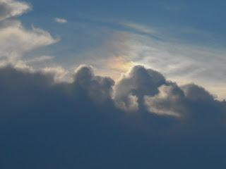
As I sat a bit stupefied on the ferry, there appeared strange-shaped clouds...

...and trees growing out at sea.

I felt much better after fish and chips from The Lighthouse at Cleveland Point, eaten from a plastic tray in the car overlooking the dark water.

January 16, 2011

The great escape

My friend got up at 4 am on Thursday, 13 January. If he set an alarm, I didn't hear it. There was no water on our ground floor. But there was water in Shore Crescent, to the side of our house. In all the talk of local flooding, I had always imagined that the water would come along Waterline Crescent directly from the river overflowing its bank to the west of us. But no. It spilled out of the storm drains, fed by the water in the newly filled creek to the north.

I got up two hours after high tide and went downstairs and into the street (below). The water had been higher. There was currently no way back home for our smart but largely impractical (at times like this) Audi A4 which my friend had parked up a hill the previous afternoon.

The river had peaked at 4.5 metres (at the Brisbane City gauge), almost one metre lower than in 1974. There was a collective sigh of relief in many suburbs, including ours. It had been expected that the river would reach 5.2 (1974: 5.45). There were still, however, 67 suburbs with properties that had been completely flooded; very many businesses wiped out across the city; roads structurally compromised; and hundreds of thousands of homes without electricity. The death toll was still rising as state emergency services personnel went about the grim task of searching damaged properties in the Lockyer Valley – and further afield – as flood waters receded and debris beached up the coast.

Despite all the hoo-hah about Australia's third-largest city, one of the hardest-hit places has been the small community of Grantham in the Lockyer Valley, where most of the 20 victims of Southeast Queensland's floods lived. Grantham's 370 inhabitants are still evacuees, not having been allowed back to their homes as wreckage-sifting SES workers may yet find more bodies. Twelve people are still missing.

We were confident that the river wouldn't peak any higher with that afternoon's high tide, so by mid-morning we started gradually carrying stuff downstairs again. I went to my Pilates class in an attempt to restore normalcy (I will never complain that the aircon is too chilly again): my friend went to retrieve the car and to buy ice. Many of the roads in neighbouring Hawthorne were flooded and closed, but the water in our immediate vicinity was receding rapidly.

A continuing lack of power meant supper preparations before nightfall and early to bed.

By the way, in case you've missed the joke before, this is where we live.

On Friday my friend returned to work: the tunnels had not been flooded. And on Friday, as promised by Lord Mayor Campbell Newman, the clean-up began. Mud-scrapers and brushers, debris gatherers, street-cleaners, sandbag collectors – they were out in force in a myriad small trucks and utes.

There was a low point when, having texted nearest and dearest back home in the UK that we were safe and dry, the battery on my mobile was almost drained. We still had no power (although Oxford Street was reconnected yesterday) and I felt very cut off. But when I went to the supermarket, they charged my phone on the desk while I did my shopping. And a lady in the queue for coffee at the Deli told me the library had Wi-Fi. Things were looking up.

Since Wednesday we'd been eating food from the freezer before it perished: tonight was no exception. Then, much as we love candlelight, we ventured up to Oxford for some light and life, our neighbours still largely absent because of the lack of power. And we were relatively late to bed – oh, it must have been nearly 10.

On Saturday the city-wide clean-up continued apace, this time augmented by thousands of volunteers. There were people everywhere – Council workers, volunteer organizers, water company people and, to our great delight as we returned from a fruitless search for gas lamps, Energex technicians. We were finally reconnected to the power supply on Saturday afternoon. What a relief. There was still much to carry downstairs, and neighbours once again came to our aid.

On Sunday, yet more clean-up volunteers took to the streets all over the city, muddied but unbowed. The evening was calm and lovely, so once more we took a beer and went to gaze at our river. (This might become a pre-sunset habit.) To look at the water, you could never have imagined it a cruel, raging torrent. I had to take the concluding comparison photograph, but I couldn't stop there...


One consequence of Brisbane's recent trauma that will impact on us most is the loss of the CityCats and City Ferries. Although most of the boats were moved to safety before the flood, the terminals have taken a bashing. Living in a waterside suburb, we use the ferries several times a week; to go to the market at New Farm, to cross the river for running or cycling along the north shore (and on the floating Riverside Walkway, which was also washed away), to go into the city for shopping or the evening, and to give visitors to Brisbane a pleasant introduction to our home town.

Busy Bulimba ferry terminal, August 2010
Over the last five years, the CityCat service had been expanded, with new vessels and many more passengers. Thousands of Brisbanites use the ferries each day to get to work. It is an extremely efficient system as well as a symbol of this city's ambition. There has been a dearth of information about the ferries' fate over the last few days, except this sign at all terminals.*

Ultimately, of course, we were extremely lucky. Many people in regional Queensland to the north and west of Brisbane, and in lower-lying suburbs of the city, were not so lucky. Many Queenslanders complain that there is undue focus on the southeast of the state, and especially the state capital: but the fact is, Brisbane means more to people on the other side of the world than Goondiwindi. Several friends in the UK, however, commented on how alarmist was foreign reporting of Brisbane's woes. Perhaps they imagined that what happened in Toowoomba and the Lockyer Valley was also happening in the city.

Our internet connection was re-established on Sunday. I was shocked to learn that more than 600 people had died in mudslides in Brazil while Brisbane was waiting for the river to rise. I don't remember that even being mentioned on the national and international news bulletins 'on the hour every hour' as my ears were glued to my local radio station. I hope I'm mistaken.

* The following day, Lord Mayor Campbell Newman announced that it was going to cost between $70 million and $100 million and take between 18 months and two years to restore the service.


January 12, 2011

The flood, day 2


High tide was at about 3am. As soon as my eyes opened a couple of hours later, I wondered if, when I raised the blind, I'd see water in Waterline Crescent Park. But no. And we had sunshine at last. Instantly spirit-lifting, despite the dire threat we were under.

While we still had power, I washed (clothes and hair) and cooked – so we will have soup (leek and potato) and sausages that we can eat cold while camping in our bedroom. Every time we went upstairs, we carried something else to higher ground.

We walked to the river for the first time today at about midday. The normally almost deserted neighbouring roads were heaving with spectators – in cars, on bikes and on foot. I took the comparison photograph (see also, further below).

We walked to the end of the jetty, from where there was a much better view of the swirling, rapidly outgoing flood water in the middle of the river. Near the bank the tide was moving water upstream – I'd never seen that phenomenon before. We watched a tug battling its way towards the city. Progress was painfully slow, and at times the vessel looked as if, were it to veer slightly to right or left of head-on to the flow, it would capsize. All the time it was dodging debris – which by now included boats, whole pontoons (one complete with bench, below), tree trunks and a miscellany of large objects. Why was the tug struggling in the middle, we wondered, instead of hitching a ride on the tide by the banks? A fellow spectator ventured his opinion that it was looking for bodies washed down from the Lockyer Valley or Toowoomba. The tug was soon joined by a police launch so maybe he was right, if more than a little macabre.


The route of an old creek – normally dry and grassy and close to our local children's playground, complete with brand-new shade sails, and dog off-leash area – which we cross to get to Oxford Street (Bulimba central) via the river walkway, had reverted to its former glory.

From the jetty, we looked back towards where we live and where we walk. The water appeared voluminous. From the path, we could virtually see it rising before our eyes.

Shortly after we returned to the house we lost power. This was a bitter blow. I had expected it much later in the day, if not tomorrow. I hadn't blended the soup, goddamit. Or made a big flask of tea. Or finished this post. There was no warning either. ABC Brisbane have been brilliant at reporting anything and everything as it has developed since tuesday. Surely the energy company could have called them to warn the residents of Bulimba and Hawthorne half an hour beforehand. The water was not rising that quickly. This was not the last time I would curse Energex. We still had gas, however.

With help from neighbours – and the guy trying to sell our house – we managed to get the big, heavy stuff – washing machine, fridge-freezer, dining table and two sofas – upstairs. Everything was now safely above the 5.5-metre level predicted (at Brisbane City gauge) for the high tides at 4am and 4pm thursday.

Exercise room
Guest bathroom
Single spare room
Landing
Downstairs
The next high tide today was around 3 to 3.30pm. Off we went to have another look. The water lapped almost gently over the footpath.


And yet another comparison photograph (and roughly the same view, taken 24 hours previously, below it).


At about 6pm, I suggested we take beers to the river – our third watch of the day. There was a beautiful sunset developing and a convivial atmosphere among fellow gatherers and neighbours. Based on recent revisions to the predicted high-tide levels for thursday by the Bureau of Meteorology and our own observations over the last few hours, my friend bravely revised his estimate of what might happen to our ground floor, and pronounced that it would not be flooded. We drank to that. But at the same time, if we'd been helpless before in the watery face of nature's force, then there lingered an overwhelming feeling of inevitability about what would happen, or not.

A ray of hope for Brisbane?

Doubtless the stress and the beer were having an effect, but I suddenly felt enormously protective of my adopted city and its mighty river. My christmas visit to Melbourne, which included promenading along that city's much less imposing Yarra River, only served to emphasise that the Brisbane River is this city. Strong words of encouragement from ABC Brisbane's rather bizarrely named daytime presenters (Madonna King and Kelly Higgins-Devine), Queensland's Premier Anna Bligh and Mayor Campbell Newman still rang in my ears. Whatever destruction and tragedy befalls this 'New World City', the people of Brisbane will rebuild... and doubtless live to witness more flooding in future.

And still the debris came down in the twilight.

We returned home for a fine supper of leek and potato soup followed by escalopes – thanks to gas and matches. It was early to bed, of course. We couldn't read by tea-light. And we were dog tired from lugging. Most of our neighbours, a lot of them with young children and therefore needing hot water and the like, had moved out, so it was quiet, and dark. I slept like one of the logs careening downriver and completely missed the 4am highwater.


January 11, 2011

Toowoomba and the waiting game

No one watching the video footage of the flash flood in Toowoomba on the news last night could not have been shocked as the Dinky-Toy cars and vans were hurled against trees by the raging brown flood wave and bystanders waist deep in water looked on helplessly.

Everyone's heard about the devastating floods further north in the state in the last few weeks, and now the warnings for the southeast, plus seemingly endless forecasts of more rain, but this surge came (and went) so rapidly that even hardened, unflappable Queenslanders were shocked.

Toowoomba lies 127km west of Brisbane, at 600-700 metres above sea level on the edge of the Great Dividing Range. It is an important regional centre serving the Darling Downs. No one anticipated what happened in the city's central business district yesterday. Despite weather-forecasting and flood-predicting computer models and Bureau of Meteorology hydrologists working 24 hours a day, several local factors conspired to create a relatively small-scale event that wasn't picked up until emergency services received calls.

A super rainstorm produced by a high-level low dropped 80mm in half an hour as uplift on to an escarpment intensified a weather system that would not itself have been extraordinary had it not combined with excessive runoff in the Lockyer Valley (where soils are saturated) to produce rapidly rising rivers and creeks.

As I write, eight people are known to have died in Toowoomba and 72 people, included entire families, are unaccounted for in the Lockyer Valley.

All that water is now headed for the state capital. Several currently swollen Darling Downs rivers join the Brisbane River just below the Wivenhoe Dam, built after the devastating floods of 1974. The Brisbane's own catchment is huge, and a greater volume of water has rained down lately than preceded the '74 floods. The reservoir is currently at 173% capacity. The predicted high for the river level in the city tomorrow – at high tide and with spillage from the dam – is estimated at the moment to be almost as great as in '74. Figures are constantly being updated.

And so in Brisbane and the southeast we wait. As the people of Emerald and Rockhampton, and Bundaberg and Theodore and Maryborough and Gympie did before us. And still it rains. We have become accustomed during the big wet of the last few months to checking the Bureau of Meteorology's radar map (top) to see what is heading our way. There is small consolation to be had at the moment.

In this part of the world, rainstorms can last for hours, even days, but sooner or later the sun banishes massive grey accumulations. That hasn't happened for a long while here. For eight days, sun glimpses have been few and far between. Tomorrow, forecasters say, rainfall will ease, but that won't affect the surge headed my way. Bulimba is on the at-risk list (below, the river at 2.30pm today).

By mid-afternoon, there was lots of activity everywhere: people hurrying home from work; a stocking-up of supplies in the supermarkets (by the time I went for a few things there was already no bread, no bottled water and very little milk); sandbags being unloaded and placed in position; and our favourite riverside restaurant being evacuated. And all the while, people were taking up vantage points down by the riverside to stand and stare (my friend holds the red and green Basque umbrella on the jetty below); and to witness the turbulent flow and debris already hurtling towards the ocean on what they knew would be yet another historic moment in the flood history of this city.

Bulimba ferry terminal


By now parts of West End were flooded and department stores in the CBD were shutting up shop as the waters crept ever nearer to the city's heart. The Port of Brisbane closed.

At home, we began countless stair climbs laden with books, smaller pieces of furniture, food supplies, rugs, ornaments, paintings, lamps, candles and mozzie-zapping supplies. As State Premier Anna Bligh gave the first hint that river levels might reach 1974 limits, my friend calculated that would mean half-way up our ground-floor walls. We hastened the evacuation upstairs.

We walked down to the river at about 9.30, drawn irresistibly. Pockets of people, huddled under umbrellas still, stared at the torrent as if searching for an answer, or willing the waters not to rise any further. But the silence was palpable.