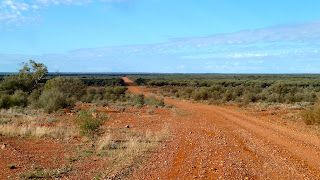
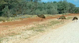
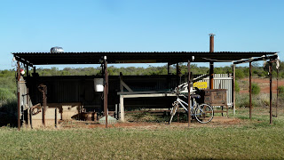
As we were leaving Kilcowera Station, Toni warned us about the weather forecast: a 90% chance of 20 mm rain by afternoon. What could we do other than continue with our plans? The alternative was to try to rearrange at least the next three nights' accommodation, and head north instead of south. We had to take a chance. Toni gave us some tips about driving on dirt roads in the wet. The sky didn't look like trouble... except, was that nascent mackerel?
It seemed like a long way to Hungerford, perhaps because the weather factor had made us a little anxious, and The Dowling Way was taking us east before we could head west. Instead of ambling along, perhaps ducking into Currawinya National Park – of bilby and bird breeding fame – we now felt the sooner we got to Tibooburra the better.
Within an hour we were driving alongside the Wild Dog Barrier Fence. This used to be called the Dingo Fence and was originally built in the 1880s to keep dingoes out of the southeast where they had been been more or less eradicated. At 5614 km, it is the world's longest fence and extends from Jimbour near Dalby on the Darling Downs in Queensland to the Eyre Peninsula on the Great Australian Bight in South Australia. In Queensland, two-man teams check 300-km sections of the fence each week.
Hungerford was another of those places where I somehow expected more. It's really just the Royal Mail Hotel, dating from 1873. We had a coffee and filled up with diesel – the most expensive ever, at $1.96 a litre. But this is remote.
The lady who served us was more optimistic about the weather prospects. She was confident we would reach Tibooburra before the rain. And so we passed through a gate in the Dingo Fence into New South Wales.Some things were unexpected on the next, Hungerford to Wanaaring leg of the journey.
We stopped to talk to the man on the bicycle near Mooleyarra. He was not young. From a sheep station near Ivanhoe in central west New South Wales, he was on his way to Quilpie, which he estimated would take him six days. He claimed to have cycled all over Australia and a sticker on his bike suggested we 'Ban all state governments'. Living in Queensland at the moment, I tend to agree with him. Bizarrely, right behind him was the rather pretentious (for these parts) entrance to a property.
For most of the way from Hungerford the Paroo River had been just to our right. We didn't see it either at Hungerford or Wanaaring, but here's a photograph of it I took earlier, at Eulo west of Cunnamulla. You'd be forgiven for not being able to distinguish it from several other chalky watercourses I've featured along the way. The track surface varied widely – we were in New South Wales – and there was no road kill. Was this because no road trains took this road, or because there were hardly any vehicles at all? I think we saw one in 100 kilometres.
Ten kilometres east of Wanaaring we turned west on the road from Bourke, the closest we got to this renowned town on the Darling River 800 km northwest of Sydney. I knew I was in a different world when I spotted a 'wild goat muster' sign. I was well and truly back o' Bourke after all, and about to head into further nothingnesss. Unfortunately a large rain cloud was passing over Wanaaring and soon made it's presence felt.
In Wanaaring General Store we had the least helpful, most unfriendly reception in the whole of our Outback trip. While my friend got told off for trying to pay for crisps at the post office counter, I asked if anyone had heard a recent weather forecast. I was told to look up: I assume the woman meant once I got outside the shop. She encouraged us to stay put for a while to allow the unsealed tracks to dry out, so we wouldn't mess them up for the locals. I didn't notice any reluctance to take our tourist dollars, however. We didn't feel like hanging around in Wanaaring and the road to Tibooburra wasn't closed. It soon stopped raining and the sun came out. There was another rain cloud moving across ahead of us but we avoided it by stopping for lunch soon afterwards. The western sky looked benign.
We came across some old friends, the Belties. An additional road hazard had been added to our list that day, too. I have no idea if these goats were feral or not, but they certainly appeared to be eating their way through this part of the world.
We were travelling by now in beautiful warm sunshine: there was lots of red earth but little else. We gradually became aware, however, of a massive black system slightly to the left of where we were headed. It seemed to be moving southeast but slowly. We were still some 100 kilometres away from Tibooburra. I found myself accelerating as I realised we were racing against time.
I was aware that the road would eventually turn northwest towards Sturt National Park, away from the storm, and wanted to get there as quickly as possible. There'd been numerous small dry lakes marked on the map: we were south of the Bulloo River Overflow region where huge amounts of water wash over when the Bulloo is in flood so that the lakes, waterholes and swamps get filled. This is a terminal flood plain that collects all the excess water from the Bulloo River system. Suddenly the road turned south. We tried to find the old track, the one on our map, but it was barely discernible and we couldn't risk it. The detour was clearly marked as the new route, to avoid swampy ground, we concluded; and further away from the clear skies to the north. The now white stony track emphasised the blackening sky.
We completed the three-sides-of-a-rectangle diversion and were back on track. But then the road turned southwest again, for about six kilometres before the northwest turn. As we approached the turning, big drops fell out of the sky. We quickly changed drivers: jumping at lightning is not conducive to staying on the road. Despite heavy rain, the track remained OK for a while although the landscape was visually diminished by the downpour. Inevitably the track deteriorated as it got wetter. The wheels were noisily churning up clods of earth, some of which were projected over the roof to land on the windscreen. The temperature had dropped from 27 to 17 degrees.
We came to the junction with the Gorge Loop Road into Sturt National Park which we'd earlier planned to take. But now the only thing that mattered was to safely negotiate the shortest possible distance (about 25 km) to Tibooburra on what felt at times like an ice rink. Someone had driven along ahead of us. We watched his tracks veer off at times as he'd lost control. This wasn't enjoyable. This wasn't in the scheme of things. What of tomorrow's plan for walking in Sturt and a leisurely drive to Cameron Corner – where three states meet?
The rain became lighter, as did the sky; my mood became darker, as did the day. The landscape in the approach to Tibooburra was, frankly, bleak. By the time we checked in at Toole's Family Hotel in Briscoe Street and unloaded everything muddily into our cabin, there was nowt for it but to hit the bar.
We chatted to a worker from the oil and gas fields of Noccundra north of the border; to two couples who had driven from Cameron Corner. No one seemed to have come from Wanaaring except us: I surmised our route had already been closed. There was a lot of speculation about weather and road conditions tomorrow. We were all willing the rain to stop as soon as possible, but it was still falling steadily when we turned in for the night.


