

click on pix to see them big


On the way to Charleville I had felt the landscape was not outbacky enough; there was too much vegetation and it was too tall. Now the sky was bigger, there were fewer trees and emus were stepping out. However, it was still too... civilised somehow.


Along the Adventure Way there are interesting diversions.

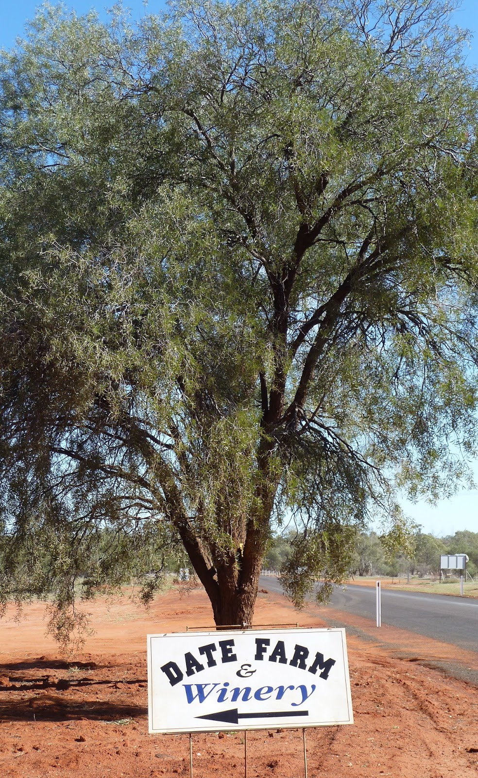

Winery? On such parched earth?

We chose birdwatching. We thought we saw a Hall's Babbler. I was tempted to walk out into the sand, although the two were not connected.

This sign surprised me. I don't think I've ever seen a signpost to a litter bin before. Ever. And why there?


Then it was time to leave sealed roads behind as we travelled down part of The Dowling Track, which was busier than expected. This Track runs from Quilpie to Bourke (as in 'back o Bourke') in New South Wales and was named after explorer and pastoralist Vincent Dowling who traced the courses of the Paroo and Bulloo rivers. I had initially searched for accommodation in Thargo but then I discovered Outback Beds (http://outbackbeds.com.au). And so it was that our next night's accommodation was at Kilcowera, a remote cattle station. With hindsight, I wish it had been two.


 We were the guests of Toni and Greg. We stayed in the basic but comfortable Shearers Quarters. Our bathroom facility was a small block out the back where hot water was delivered at 47 degrees from the Great Artesian Basin 368 metres below. My friend got terribly excited at the prospect of geothermal showers. But first we drove to Cardenyabba Lagoon. To our great disappointment there wasn't much birdlife, with the exception of a squadron of pelicans returning, we assumed, to Lake Wyara in Currawinya National Park. The reflections and the sunset were equally as impressive. You can camp down by the Lagoon – open fireplace and wood supplied.


 We sat down to a hearty supper with Toni and Greg and were given food for thought when I asked where the Outback began. I was pleased that Brisbane seemed a world away. Later, there were so many stars in the Milky Way it looked like cloud. We slept deeply in the perfect silence.
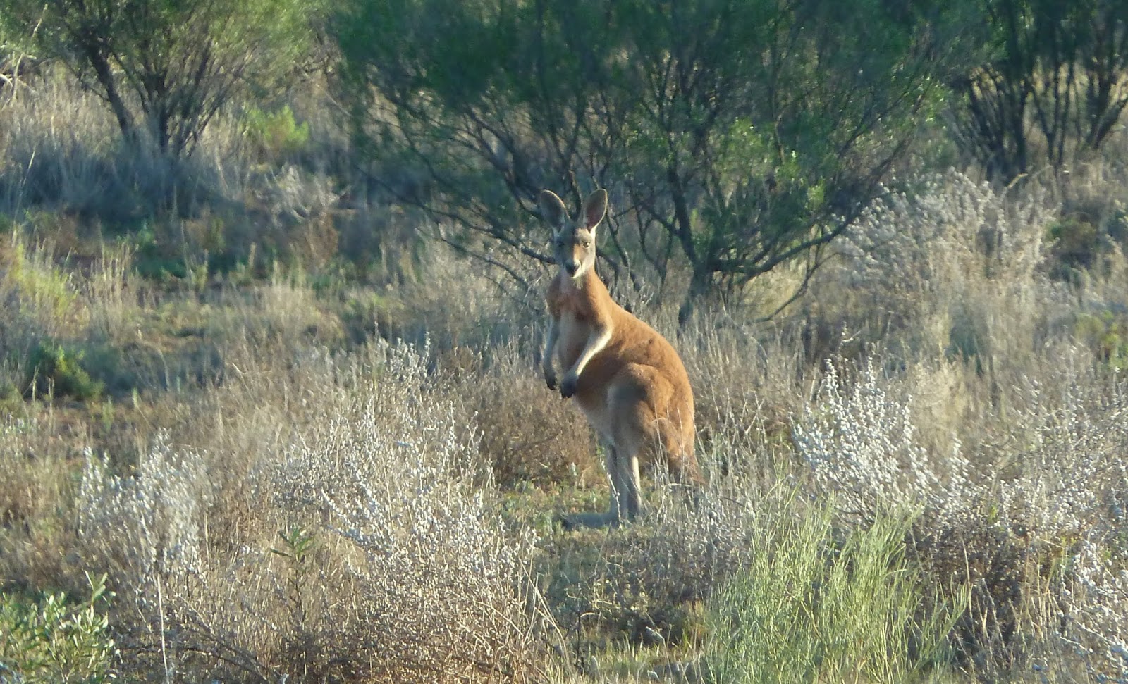
The following morning we got up early to visit Red Hole. Often we were being watched. (Bottom below: a Nankeen Kestrel.)


 If we'd had a full day at Kilcowera Station we could have driven to Lake Wyara, a saline lake shared by both the Kilcowera property and the Currawinya National Park. It is the breeding site of thousands of migratory birds and pelicans, swans, shags and terns. We'd have learned a lot more about this 49,377-hectare station, too. When planning a trip of this kind, you research the possibilities, talk to people if you can and make choices. You win some, you lose some; and then you can make better recommendations to fellow travellers. So, if you pass this way, stay at least a couple of nights at Kilcowera Station.
But us, we hit the road again.


The following morning we got up early to visit Red Hole. Often we were being watched. (Bottom below: a Nankeen Kestrel.)


But us, we hit the road again.


No comments:
Post a Comment